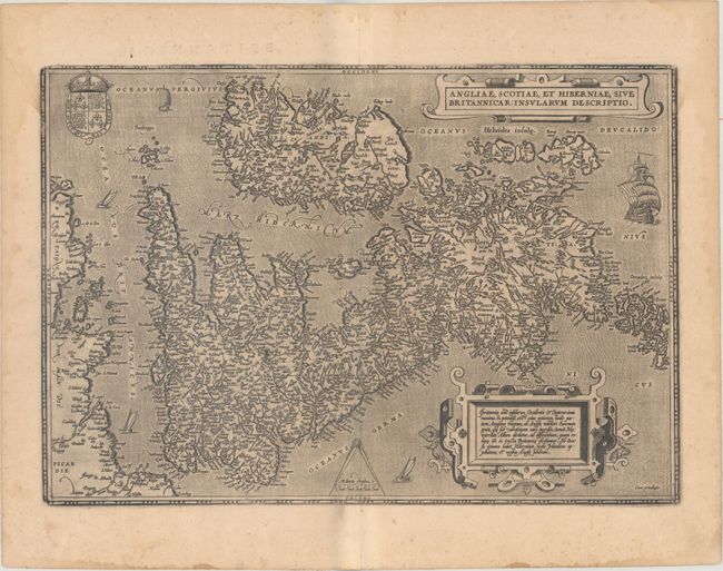
Subject: Britain
Period: 1603 (published)
Publication: Theatrum Orbis Terrarum
Color: Black & White
Size:
19.6 x 13.6 inches
49.8 x 34.5 cm
This map, based on the cartography of Gerard Mercator, is Ortelius' earliest map of Britain. Flemish influence, or possibly a mistranslation, is evident in the rendering of some of the place names, e.g. Ormyskyrk for Ormskirk, Dantre for Daventry, and the omission of the relatively important Peterborough. Distinguished by a sophisticated style of engraving, the map is embellished with two ornate strapwork cartouches, the royal coat of arms of the UK, dividers and distance scale and five sailing ships. Latin text on verso.
References: Shirley (MCC-94) #86, pl. 42; Van den Broecke #16.
Condition: B+
A dark impression on paper with the horn coat of arms commonly found on Ortelius' maps, light toning, a couple of minor printer's creases, and some damp stains along the edges of the sheet.