Catalog Archive
Auction 166, Lot 370

NO RESERVE

"A Chart of the Coast of Guayana, from the Entrance of the River Orinoco, (in the Lat. 8.30.' N. Long. 61. W. from London) to the Entrance of the River Amazones", Mount & Page

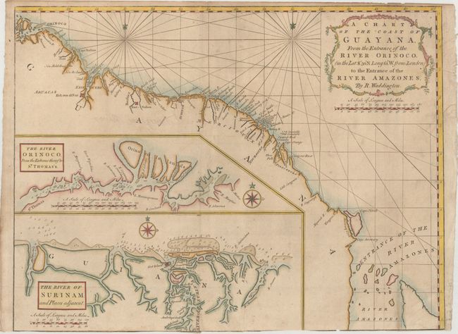
Subject: Guyana, Suriname, French Guiana

Period: 1775 (circa)

Publication: The English Pilot

Color: Hand Color

Size:
24.1 x 18.2 inches
61.2 x 46.2 cm
Download High Resolution Image
(or just click on image to launch the Zoom viewer)

This navigational chart depicts the coastline from the Orinoco to the Amazon rivers, with many small islands, navigational hazards, and two forts noted (Kick over all Fort and Fort Nassau). Two large insets show the entrances to the Orinoco and Suriname Rivers in great detail, with numerous soundings. The map is attributed to Robert Waddington.

References: Sellers & Van Ee #2145.

Condition: B

Issued folding, now pressed with light soiling and two archivally repaired tears that enter 1.5" at top right and 3" at bottom right into map. Trimmed to neatline at bottom, with minor loss of neatline.

Estimate: $180 - $220

Sold for: $41

Closed on 2/14/2018

Archived