Catalog Archive
Auction 166, Lot 368

Superb Early Chart of the Venezuelan Coastline Including the ABC Islands

"Pas-kaart vande Zee Kusten van Venecuela met de Byleggende Eylanden", Keulen/Vooght
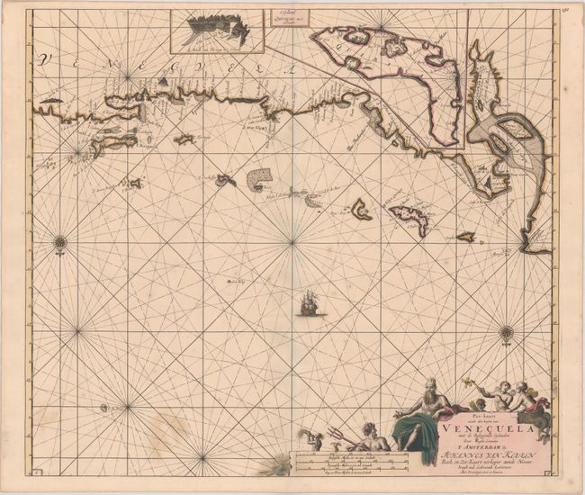
Subject: Venezuela

Period: 1700 (circa)

Publication:

Color: Hand Color

Size:
22.9 x 20.2 inches
58.2 x 51.3 cm
Download High Resolution Image
(or just click on image to launch the Zoom viewer)

A superb sea chart covering the Venezuelan coastline and the Netherlands Antilles of Curacao, Bonaire and Aruba. Insets provide detailed information on Curacao and the Dutch fortress and salt works on Isla La Tortuga. The chart is oriented with north at the bottom by two compass roses and includes a large title cartouche featuring Neptune, the lord of the sea, with his entourage. The Van Keulen firm dominated Dutch sea chart publication for much of its existence between 1680 and 1885.

References:

Condition: B+

Original color on paper with a watermark of the initial "P", some color offsetting, a few spots of foxing, and a couple of minor cracks at bottom right that have been archivally repaired on verso.

Estimate: $1,100 - $1,400

Unsold

Closed on 2/14/2018

Archived