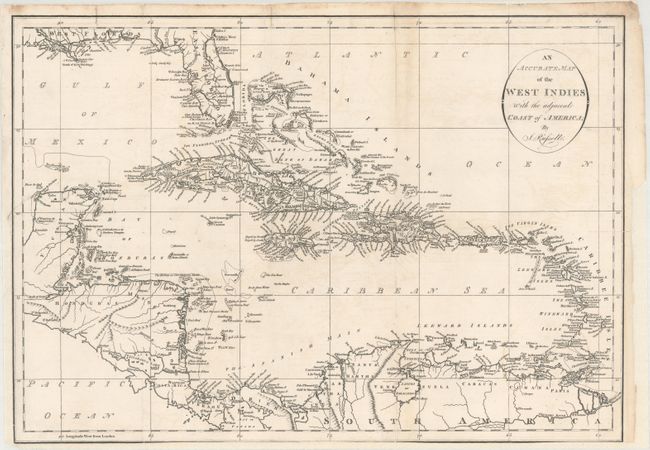
Subject: Caribbean
Period: 1794 (circa)
Publication: Am American Atlas…
Color: Black & White
Size:
19.6 x 13.8 inches
49.8 x 35.1 cm
This detailed map of the Caribbean shows mountains, rivers, lakes, towns, bays, islands and shoals. The southern part of the United States, including Florida and the Mississippi Delta, is shown at the top. East and West Florida are depicted. This is one of nine maps engraved by Russell and published in John Reid's An American Atlas. The same nine maps were included in An Historical, Geographical, Commercial and Philosophical View of the American United States by William Winterbotham (1763-1829) published in London in 1795 and 1799 and in New York in 1796 (some maps by other engravers). Reid's An American Atlas was meant to accompany the version of Winterbotham's history published without the maps.
References: Phillips (Maps) p. 1059; Phillips (A) p. 751.
Condition: B
On a bright sheet that is issued folding and now flattened and backed with heavy tissue to repair several fold separations mostly along the right fold and three small edge tears. There is a binding trim at lower left and the bottom of the sheet has been trimmed to just inside the neatline. Light soiling and faint offsetting.