Subject: Southwestern United States & Mexico, Texas
Period: 1840 (circa)
Publication: Black's General Atlas
Color: Hand Color
Size:
14.6 x 10.2 inches
37.1 x 25.9 cm
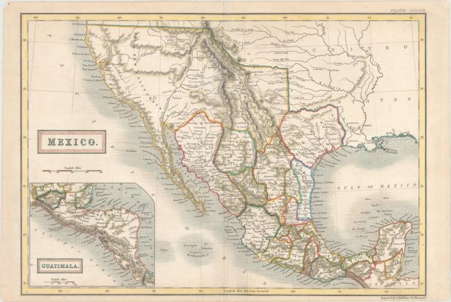
This is an early edition of this attractive representation of the present-day southwestern United States, Texas, and Mexico. The Independent Republic of Texas is bound by the Nueces River rather than the Rio Grande on its southern border. In Upper or New California, there is an American Fur Co. Depot on the eastern shore of L. Youta or Salt L.. In New Mexico, the Great Spanish Road is shown from the Red River on the Texas boundary to Santa Fe, and then heading south through the length of Mexico. The map continues into Central America in an inset of Guatimala. The Great Basin shows pre-Fremont information with numerous rivers including the River Buenaventura which runs straight through on its way to the Pacific Ocean.
References:
Condition: A
Marginal soiling with a few tiny chips and tears along the edges of the sheet.