Subject: Arlington, Virginia
Period: 1888 (published)
Publication:
Color: Black & White
Size:
35.3 x 28.6 inches
89.7 x 72.6 cm
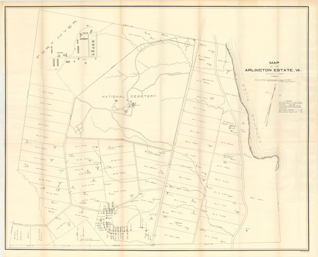
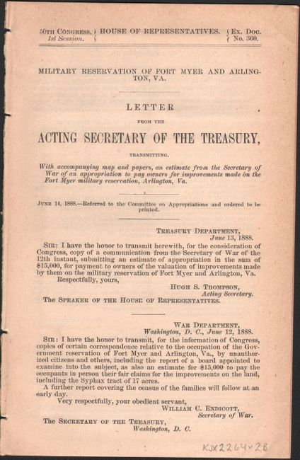
This large map shows “all buildings occupied by citizens outside of Fort Myer and the National Cemetery.” Presents an early, small version of Arlington Cemetery surrounded by numerous tracts of land with all buildings shown and residents named. Most interestingly, it does not name the Freedman’s Village in the southern portion, but it does show the buildings and the residents of each. After the property was confiscated during the Civil War, the village was established as a model community to house and train refugee slaves from the south and prepare them for self-sufficiency. The village survived until it was razed around 1900 to allow for the expansion of the Cemetery. The map is accompanied by the disbound government report with a history of the parcel and Freedmen’s Village, a petition of the residents, a listing of each “owner” and proposed payment by the government. The detail in this report and map of the residents and property provides a good picture of the area at the close of the 19th century.
References:
Condition: A
On a clean sheet with one tiny split at a fold intersection and very faint offsetting. Disbound report text is lightly toned.