Subject: Texas
Period: 1838 (dated)
Publication:
Color: Hand Color
Size:
11.4 x 14.2 inches
29 x 36.1 cm
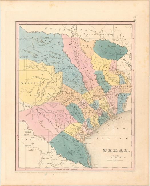
This is an updated edition of Bradford’s 1838 map showing the Independent Republic of Texas with its southern border following the Rio Grande. The map depicts empresario grants, lakes, rivers, creeks, towns and Indian villages. The Old Mexican Garrison is located on the Brazos River north of Deer Creek. The map locates and names San Antonio de Bexar, San Felipe de Austin, Sabine, St. Augustine, Nacogdoches, Zavala, Tivis, Houston, Montezuma, Waco Village, Tenoxititlan, and more. Numerous land grants are named including Stephen F. Austin, Woodbury & Cos, Cameron's (two separate parts), Zavalla's and Whelin's. The large region around Austin is called Austin's Colony. Engraved by G.W. Boynton. Copyrighted 1838 but likely published circa 1841.
References: cf. Day #32; cf. Phillips (M) p. 842.
Condition: A
Full original color with light, scattered foxing almost entirely confined to the blank margins.