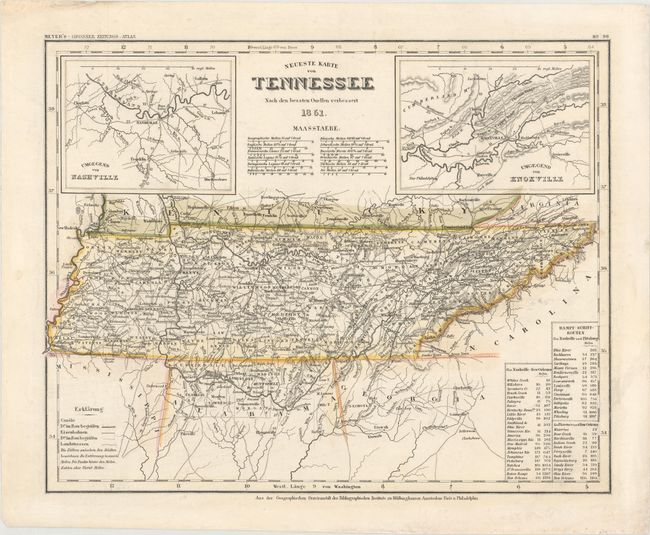
Subject: Tennessee
Period: 1851 (dated)
Publication: Meyer's Grosser Zeitungs-Atlas
Color: Hand Color
Size:
14.8 x 11.8 inches
37.6 x 30 cm
This is one of the few mid-19th century maps that depicts Tennessee without Kentucky. It identifies counties, county seats, roads, railroads, and canals and also shows topographical detail. Two insets flank the script title showing the environs of Nashville and Knoxville. A table lists the stops and distances along three steamboat routes: from Nashville to New Orleans, from Nashville to Pittsburgh, and from Florence to New Orleans. The county configuration is circa 1848, prior to the organization of Scott County in 1849. Published by the Hildburghausen Biblio Institut.
References:
Condition: B+
Original outline color on a clean, bright sheet that has some light creasing and stiffness due to having been professionally removed from a board. There is a short tear in the top blank margin.