Subject: Tennessee
Period: 1827 (circa)
Publication: New General Atlas
Color: Hand Color
Size:
11.3 x 8.3 inches
28.7 x 21.1 cm
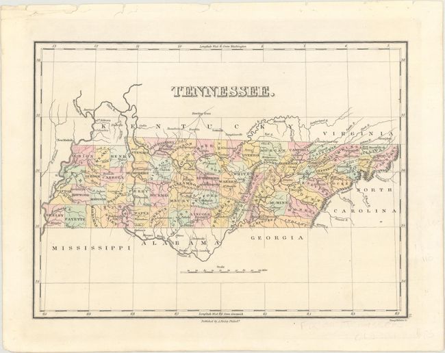
Finely's maps employ a delicate and elegant engraving style and provided extensive topographical and watershed information. He was the dominant map maker in the United States in the early 1820s into the 1830s. His atlases were very successful, outselling rival atlases by Carey & Lea, and Tanner. His maps were printed on high quality paper and were routinely corrected and updated.
Fine map of the state that details the county seats, roads, settlements, and a Missionary Station (near present day Chattanooga). County configuration is current to 1827. The capital is shown at Murfreesboro. A Cherokee Indian Reservation is shown in the southeast corner of the state, and there are 61 counties. The map was crisply engraved by Young & Delleker.
References:
Condition: A
There are binding holes and a few tiny tears in the top blank margin, otherwise fine.