Catalog Archive
Auction 166, Lot 271

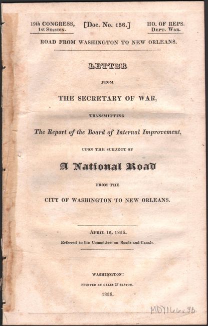
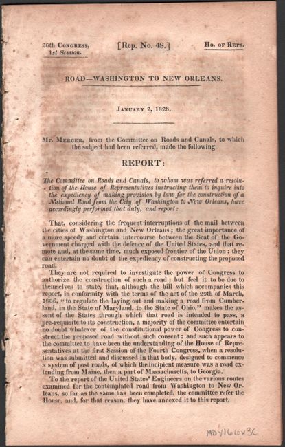
"The Two Routes Surveyed for the National Road from Springfield to Richmond [with reports]", U.S. War Department

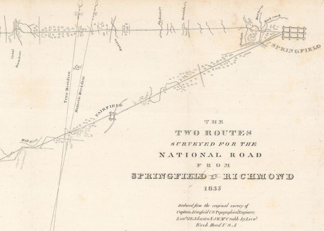
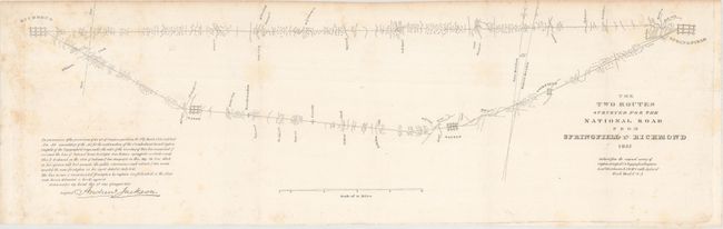
Subject: Western Ohio

Period: 1826-35 (dated)

Publication: HR Doc. 62, 24th Congress, 1st Session

Color: Black & White

Size:
24.3 x 7.2 inches
61.7 x 18.3 cm
Download High Resolution Image
(or just click on image to launch the Zoom viewer)

This map traces the National or Cumberland Road through western Ohio from Springfield to just over the border to Richmond, Indiana. Fairfield, Dayton, and Eaton are identified along with rivers, creeks, and canals. Lieutenant Washington Hood reduced the map from a survey headed up by Captain A. Canfield. The plate features the signature of President Andrew Jackson. This lot includes two reports related to the National Road, HR Doc. No. 156, 19th Congress, 1st Session (1826) and HR Rep. No. 48, 20th Congress, 1st Session (1828).

References: Claussen & Friis #115.

Condition: B+

Issued folding with light scattered foxing. Reports have light scattered foxing and toning.

Estimate: $110 - $140

Sold for: $65

Closed on 2/14/2018

Archived