Subject: Long Island, New York
Period: 1836 (dated)
Publication:
Color: Hand Color
Size:
54 x 36 inches
137.2 x 91.4 cm
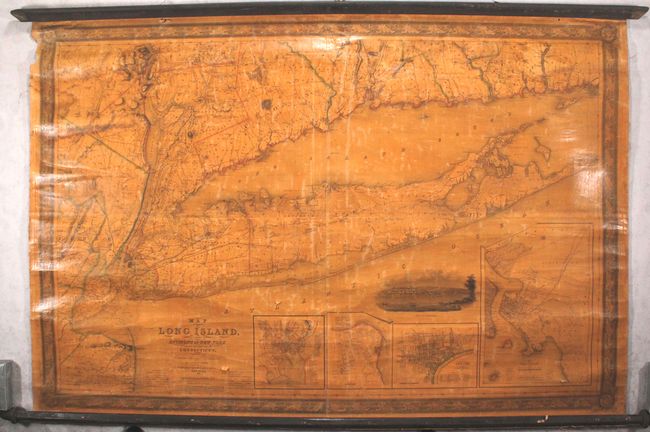
This large-scale map covers all of Long Island from Montauk west to Brooklyn and extends to include portions of New Jersey, New York, and Connecticut. Based upon the most recent surveys, the detailed map shows completed and projected railroads, roads, canals, mills, factories and churches. Topography is also depicted via hachure. The Long Island Railroad, originally chartered in 1834, extends from Brooklyn to about 10 miles past Hicksville and abruptly stops (less than half the distance of Long Island). Below the main map are insets of New Haven, New Brighton, Newark and Brooklyn. A view of New Brighton further embellishes the map. Drawn on a scale of 2.5 miles per inch. Engraved by S. Stiles & Company and published by J.H. Colton in New York.
This map provided the topographical basis for Mather's Geographical Map of Long Island & Staten Islands with the Environs of New York published in 1842.
References: cf. Phillips (Maps) p. 532.
Condition: B
The map is moderately toned due to the varnish along with some mild cracking and light surface abrasions. There is a small puncture along the top border and a chip confined to the left blank margin. The bottom roller is detached.