Subject: Montana
Period: 1876 (published)
Publication: H.R. Ex. Doc. 1, 44th Congress, 2nd Session
Color: Black & White
Size:
9.4 x 6 inches
23.9 x 15.2 cm
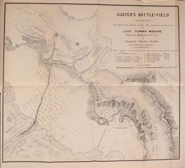
An excellent terrain map of the scene of Custer's defeat that was made shortly after the infamous massacre of the 7th Cavalry. Maguire was attached to a column that came to Reno's rescue and upon departure of the hostile Indians he proceeded to the scene of the disaster. Drawn by Sergeant Charles Becker, the map details the area, locates the graves of 12 fallen soldiers and officers, including Lt. Col. Custer. Locates the Indian Village, the course of the Little Big Horn River, Reno's skirmish line and much more of interest. In his 6 page report accompanying the map (together as Appendix OO in the volume), Maguire's comments are most elucidating on several levels, including "The Indians are the best irregular cavalry in the world, and are superior in horsemanship and marksmanship to our soldiers, besides being better armed…" A remarkable map of a most historic event.
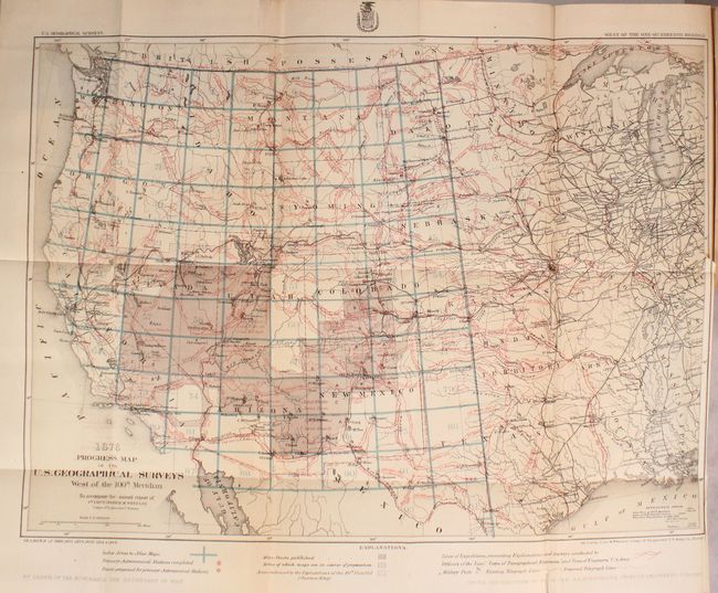
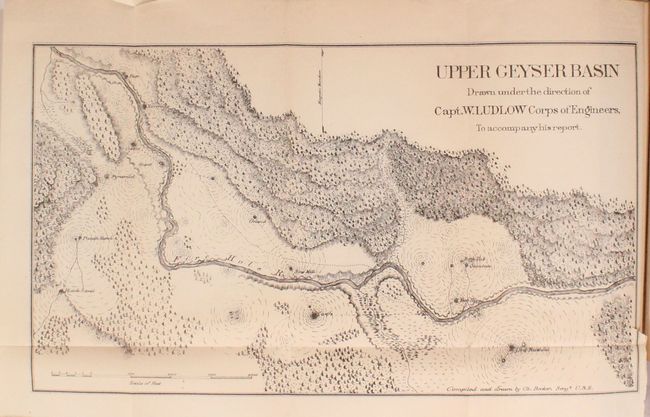
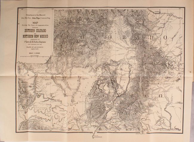
Maquire's report is still bound into the complete 755 page Report of the Secretary of War..., Volume II, Part III. There are a number of other notable reports in this volume including Wheeler’s Annual Report of the U.S. Geographical Surveys West of the 100th Meridian (with numerous maps), Ludlow’s Reconnaissance to the Yellowstone (with 3 maps), and Ruffner’s reconnaissance in Colorado and New Mexico (with one map). Octavo, hardbound in brown cloth with gilt title on spine.
References: Wheat (TMW) #1266.
Condition: B+
The maps, plates, and text are very good to near fine with pleasant light toning. The maps and plates have the typical occasional edge tear, and the first eight pages of text have small chips and edge tears in the bottom right corner of the sheets, not impacting text. There is only minor wear to the extremities with slightly bumped edges.