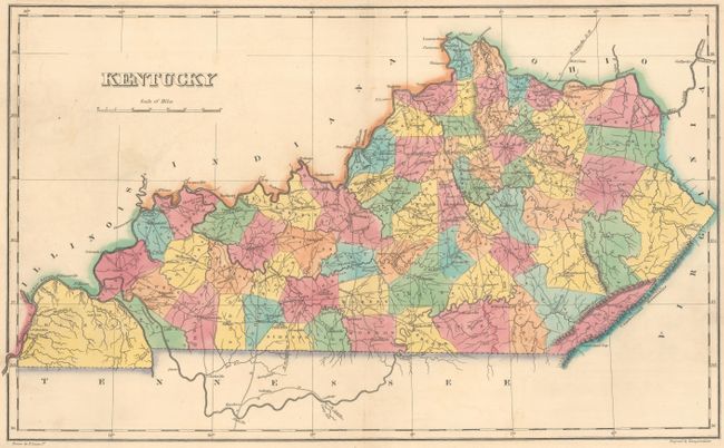
Subject: Kentucky
Period: 1822 (published)
Publication: A Complete Historical, Chronological, and Geographical American Atlas...
Color: Hand Color
Size:
18.6 x 11.3 inches
47.2 x 28.7 cm
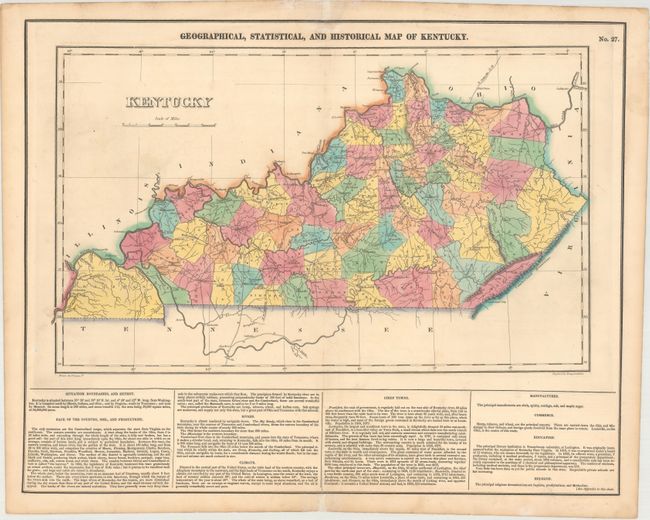
The map is on a full folio sheet (20.4 x 16.7") with English text below giving a brief description of Kentucky's boundaries, productions, rivers, climate, chief towns, manufactures, commerce, education, and religion. The finely engraved map delineates the counties, roads, and major towns. Hickman County dominates the southwest corner of the state, as it has not yet been cut down to form Calloway (organized 1823), Graves (1824), and McCracken (1825). Pike and Floyd Counties are reversed, and Morgan County does not yet appear, which was organized in 1823. Kentucky and Tennessee are almost always shown on the same map, so it is uncommon to find Kentucky alone during this period. Drawn by Fielding Lucas, Jr. and engraved by Young & Delleker.
References:
Condition: B+
Full original color with a hint of offsetting and light toning along the edges of the sheet. There are archival repairs to short centerfold separations at top and bottom and to several short edge tears.