Subject: St. Augustine, Florida
Period: 1783 (dated)
Publication: Political Magazine
Color: Black & White
Size:
9.5 x 6.6 inches
24.1 x 16.8 cm
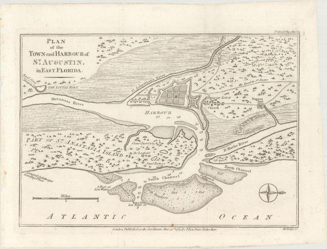
This map detailing the fortifications of St. Augustine is based on an earlier map engraved by Jefferys. It features good information on the layout of the town and fort and the soundings in the entrance to the harbor. St. Augustine is the oldest European city in the United States. Juan Menendez de Aviles established the first settlement nearly a half century before the first English settlers landed at Jamestown. St. Augustine grew to become the Spanish center of power in North America for almost 200 years. After the Seven Years' War ended with the Treaty of Paris in 1763, the British were given control of the city. With a compass rose capped with a fleur-de-lys orienting north to the right. Published March 31st, 1783 by John Bew.
References: Jolly #POL-71.
Condition: A
Issued folding on watermarked paper with a small rust spot on the border at bottom.