Subject: Florida
Period: 1848 (dated)
Publication:
Color: Black & White
Size:
48.3 x 38.3 inches
122.7 x 97.3 cm
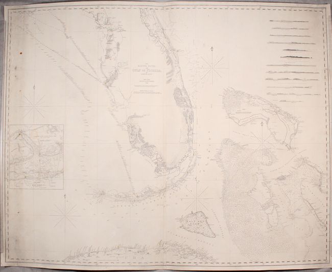
This impressive, two-sheet "blueback" chart covers much of Florida including the Keys and Dry Tortugas, the northern coast of Cuba, and part of the Bahamas. It was first issued in Blunt's 1827 maritime atlas and has been updated and significantly improved based upon the survey work of Colonel Abert (Topographical Engineers) and Commander Powel (Navy). The nautical information includes scores of soundings, hazards, currents, sea floor types, lighthouses, notes and exceptional coastal detail. Features an inset Chart of Key West by George Gauld, 12 coastal approach views, and 5 compass roses to aid in navigation. Backed with stiff blue paper.
References: cf. Phillips (Atlases) #3661-8.
Condition: B
A crisp impression on a bright sheet that has been professionally rebacked with heavy blue paper to reinforce and repair a long edge tear at both left and right. There are also several smaller edge tears extending no more than 1.5" into the image that have been professionally repaired. There is light soiling, minor staining, and a small chip in an unengraved area between the Florida Keys and Cuba. Despite these flaws that are common to bluebacks, the chart presents itself quite well.