Subject: Washington, D.C.
Period: 1879 (circa)
Publication:
Color:
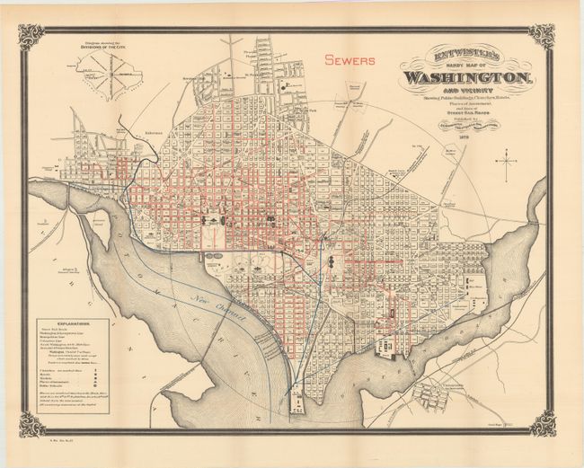
A. Entwistle's Handy Map of Washington. And Vicinity Showing Public Buildings, Churches, Hotels, Places of Amusement, and Lines of Street Rail Roads, by J.C. Entwistle, dated 1879, printed color (21.7 x 16.8"). This is a great map of the capital with all streets, railroads, bridges, buildings and monuments located and named. It shows part of Uniontown (or Anacostia), the Arlington National Cemetery, Georgetown College, and more. All surrounded by a bold border with decorative corner elements. The subject of the map is the sewage system, which is shown in full detail via red overprinting.
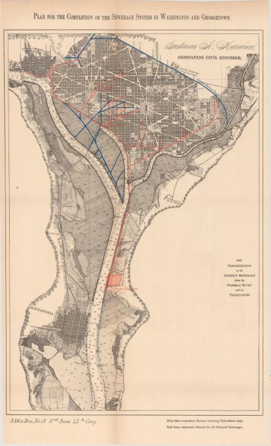
B. Plan for the Completion of the Sewerage System in Washington and Georgetown, by Gustavus A. Karwiese, printed color (11.0 x 16.4"). A smaller map showing sewer lines extending south to a Sewage Station just above Alexandria at the U.S. Naval Magazine. Blue lines indicate sewers carrying rainwater, while red lines represent sewers for "general sewage."
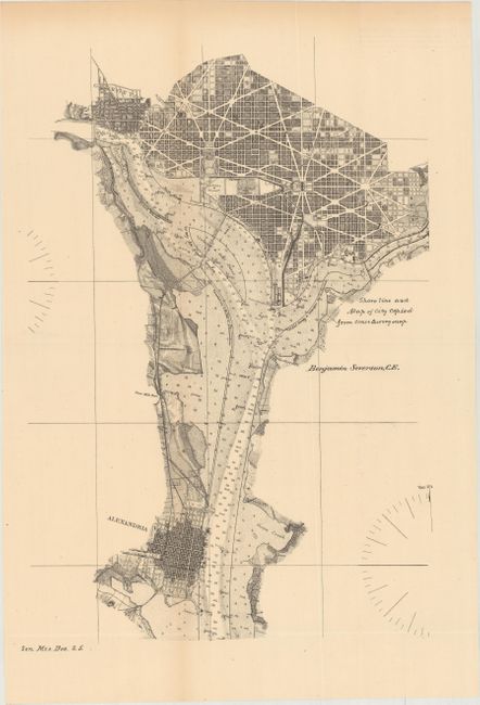
C. [Untitled Washington, D.C. Plan by A.C. Fowler], black & white (10.1 x 15.1"). This is the same base map as above but without the color overprinting. A note states that "the shore line and map of city copied from coast survey map." Signed in plate by Benjamin Severson, C.E.
References:
Condition: B+
Issued folding with light toning.