Subject: Washington, D.C., Civil War
Period: 1863 (circa)
Publication:
Color: Hand Color
Size:
7.5 x 9 inches
19.1 x 22.9 cm
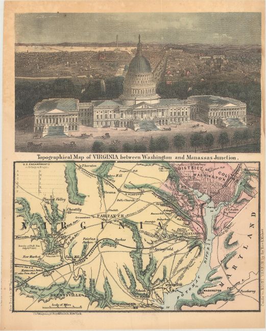
This uncommon letter sheet map was published by Charles Magnus. The top panel is a detailed bird's-eye view of the Capital Building with the city in the background. A preliminary plan of the Washington monument can be seen in the far background. This view shows the building completed with the statue of freedom on top which did not occur until 1863. The bottom panel is a detailed map of northern Virginia and Washington. It shows roads, railroads, towns and cities naming Fairfax, Mt. Vernon, Fort Washington, Hunter's Mill, Prospect Hill and Washington D.C. at upper left. At the left of the map is Battle of Bull Run with "Rebel" positions noted. Charles Magnus produced several maps and views during the Civil War and this small work has drawn on his prior work.
References:
Condition: B+
Light dampstaining at top.