Subject: Washington, D.C.
Period: 1816 (published)
Publication:
Color: Black & White
Size:
10.6 x 8.3 inches
26.9 x 21.1 cm
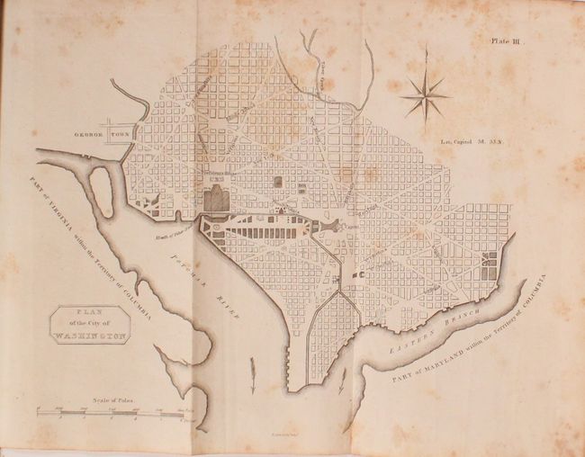
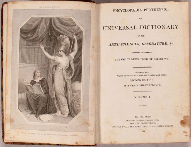
This is a rare Scottish plan of Washington, DC. The plan bears some resemblance to the size and configuration of the small plans by Thackara & Vallance, Hill, and Tiebout, all of which were printed in 1792. However this plan is not a copy of any of these other plans, making it a unique addition to any collector of plans of the capital. Cartographically, the plan shows the layout of streets including the long diagonals, but no block numbering. Washington is bordered by the Potomak (Potomac) River and the Eastern Branch, now the Anacostia River. The proposed landscape design for the Mall is shown with only the Capitol and the Presidents House labeled. This version does not include soundings in the Potomac River, and there is no block detail in Georgetown. Decorated by a simple block-style cartouche. This map was prepared by Thomas Clerk, an engraver and lithographer in Edinburgh, who is best known for engraving John Thomson's New General Atlas in 1814. At upper right is the plate number (Plate III) and at bottom center is Clerk's imprint (T. Clerk Sculp.t Edin.r). This map is extremely rare, with only a couple of dealer listings in the last 30 years. The rarity is reinforced by the map's absence from Phillips' Maps and Views of Washington and District of Columbia. The map is bound in volume I of the second edition of Encyclopaedia Perthensis, which was published in Edinburgh. The plan of Washington, DC first appeared in Volume 1 of the second issue of the first edition of Encyclopaedia Perthensis; or Universal Dictionary, which was published circa 1805 in Perth.
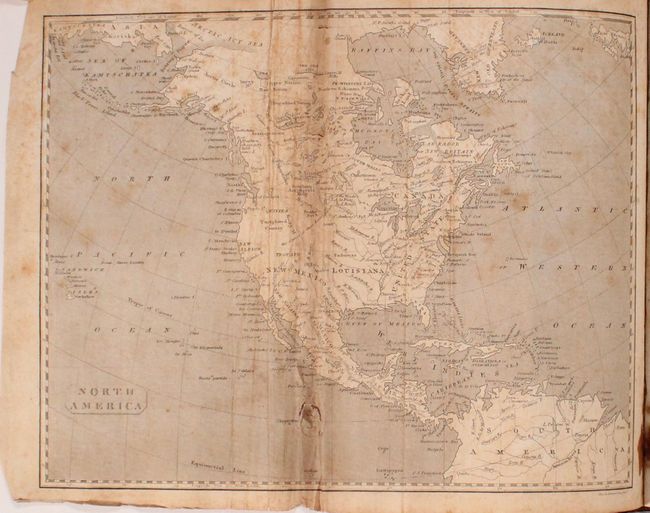
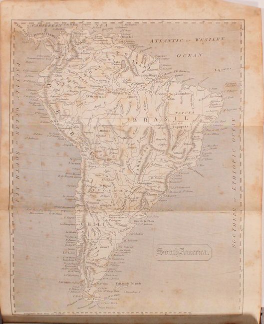
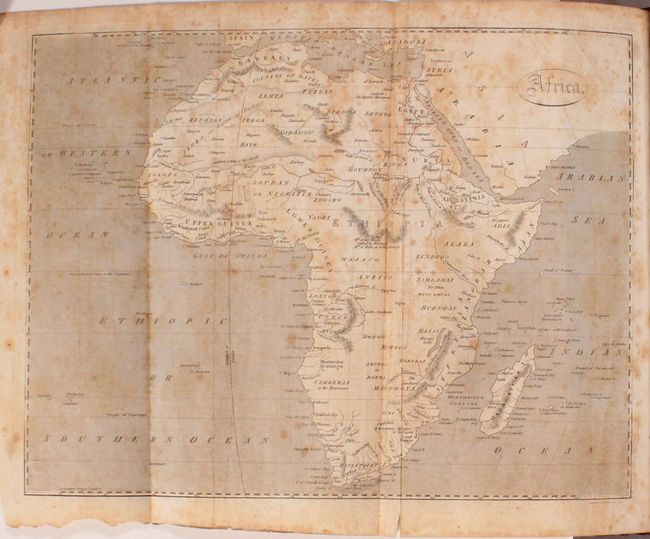
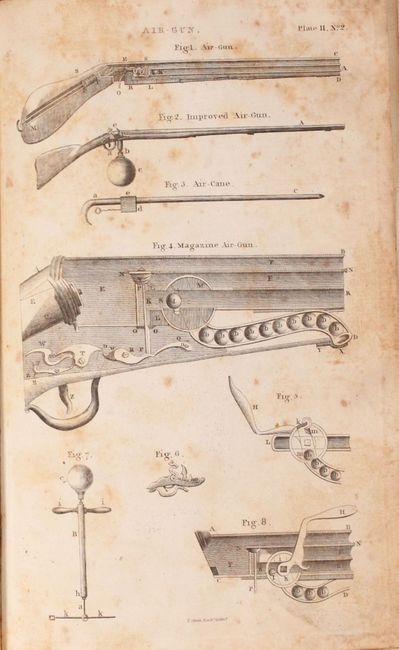
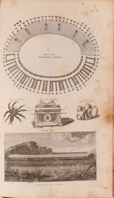
Volume I of Encyclopaedia Perthensis covers the beginning of the alphabet from A to Anatomy. Included are four maps (Washington, DC, North America, South America, and Africa), a frontispiece depicting Minerva, and four plates depicting various items beginning with the letter "A," such as abacus, aerostation, air-gun, Noah's ark, amphitheater, and anchor. The Encyclopaedia Perthensis was published in 23 volumes that included 370 plates and maps, and was intended to "supersede the use of other books of reference." Printed by John Brown.
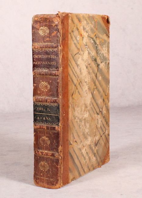
Octavo, 7 pp., 20 pp. Hardbound in quarter leather with tips over marbled paper boards; raised bands, gilt tooling, and black leather title labels on spine.
References:
Condition: B
The plan of DC has scattered foxing. The other three maps have moderate to heavy foxing, and the map of North America has several small tears in the image and some mis-folding. The plates are in good condition with moderate foxing and staining. The text has light scattered foxing throughout with a few minor damp stains along the fore-edge on some pages. The hinges have started, the covers have bumped corners with a number of abrasions, and the spine has some small chips and cracks.