Subject: Connecticut
Period: 1816 (circa)
Publication: A New and Elegant General Atlas...
Color: Hand Color
Size:
10.6 x 8.3 inches
26.9 x 21.1 cm
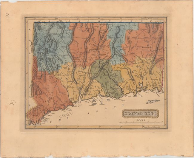
This uncommon map of Connecticut shows towns and cities, roads, and some topographical detail. Despite a publication date of ca. 1816, county configuration is current only to 1801, with a smaller Hartford County. The northern border of the state is flat without the small gain Massachusetts made in Hartford County in 1804. Drawn by Samuel Lewis and engraved by H.S. Tanner. Lucas' General Atlas is known as one of the finest general atlases produced in the U.S. at the time, due to the high quality paper, superior engraving quality, and attractive coloring style.
References: cf. Phillips (Atlases) #3542.
Condition: B+
In full original color with light toning, marginal foxing, and a couple of short tears confined to the top blank margin.