Subject: Colorado
Period: 1876 (circa)
Publication: Gray's Atlas of the United States...
Color: Hand Color
Size:
14.8 x 11.8 inches
37.6 x 30 cm
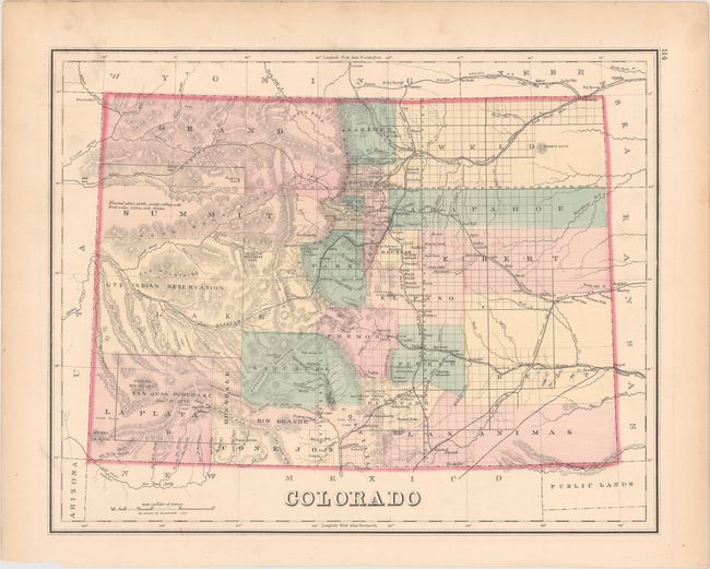
This fine map shows the status of settlement and development right around the time Colorado became a state. It details railroads, cities, towns and mining communities, watershed, forts, and more. Features extensive topographical detail in hachure. This early edition names only 25 counties with the majority of the western portion mostly unsettled with a note describing the region as "elevated plain, fertile, gently rolling, with fresh water lakes, and timber."
References:
Condition: B+
There is an edge tear at left that extends 1.5" into the image that has been closed on verso with archival tape. Light toning along sheet edges.