Subject: Arkansas
Period: 1838 (dated)
Publication: An Illustrated Atlas, Geographical, Statistical, and Historical, of the United States…
Color: Hand Color
Size:
14.3 x 11.3 inches
36.3 x 28.7 cm
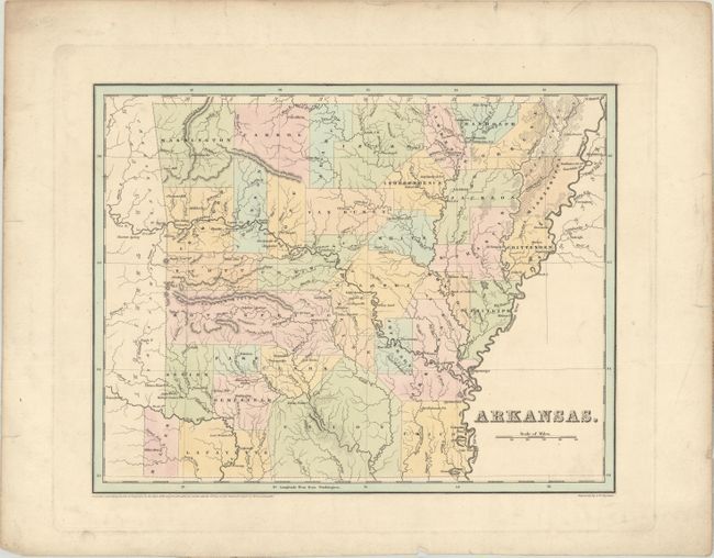
This copper engraved map was made two years after Arkansas became a state. County development is circa 1835 as several 1836 changes are not on the map; Miller is shown in the southwest, and Washington has not yet lost territory to Madison and Benton counties. The map shows good topographical, geographical, and political detail. All the counties are individually hand colored. Part of Missouri Territory is shown but not hand colored. Not a single railroad line is located in this early statehood map. Not to be confused with the more common maps from the Comprehensive Atlas, this sheet is several inches larger and carries much more information. Engraved by G.W. Boynton.
References:
Condition: B+
A crisp impression with minor surface soiling. There are a few edge tears confined to the blank margins.