Subject: Southwestern United States
Period: 1848 (published)
Publication: Sen. Ex. Doc. 7, 30th Congress, 1st Session
Color: Black & White
Size:
67.8 x 30.1 inches
172.2 x 76.5 cm
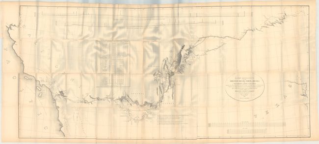
An important Mexican-American War period map that shows the route of Col. Kearny and his Army of the West as they traveled from Ft. Leavenworth to Los Angeles via Santa Fe and San Diego. Wheat states that the map was an important milestone in the cartographic development and accurate determination of the geography of the West. A large map printed on three sheets, joined as issued.
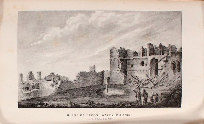
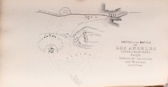
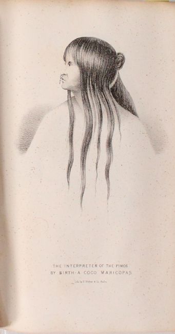
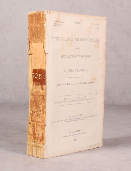
The map is accompanied by the Senate edition of Emory's important report documenting the 1846-1847 journey. Emory's reports are enjoyable reads and this is no different, with passages such as "I stopped in the little town of Isoletta, to visit my friend, the accolade, who has the reputation, Indian though he be, of being the most honest man and best maker of brandy in the territory." The report summarizes the activity of the U.S. Army of the West after the capture of New Mexico with important early views of the region. It is illustrated with 26 lithographed views, three battle maps, and 14 botanical plates. The important view of San Diego is present. The battle plans are: Sketch of the Actions fought at San Pasqual in Upper California…; Sketch of the Passage of the Rio San Gabriel...; and Sketch of the Battle of Los Angeles Upper California. Fought between the Americans and Mexicans Jany. 9th, 1847. Complete with the two page report (Appendix No. 7) by P. St. Geo. Cooke, Major 2d Dragoons. Printed by Wendell and Van Benthuysen. This is the second edition printed, and thus did not originally contain the large folding map by Emory, which was included in the first and third editions. 416 pages, 40 plates, and 3 single-page maps. Disbound.
References: Wagner & Camp #148:2; Howes #E145; Wheat (TMW) #544.
Condition: B+
The large folding map has pleasant light toning and a 2" tear adjacent to the top fold at left. Disbound text and plates have light scattered foxing. The bluish hue that is visible on the fold lines is caused by our scanner, and is not on the physical map.