Subject: Northwestern United States
Period: 1851 (dated)
Publication:
Color: Black & White
Size:
13.9 x 35.3 inches
35.3 x 89.7 cm
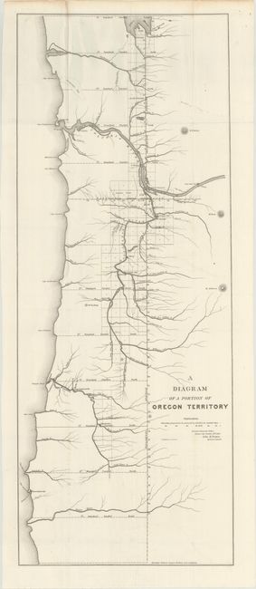
This is an early land office map that details the coastal area of Oregon Territory. It extends from the California boundary, showing no details in the south save the Rouge River, to above Portland into present-day Washington to Olympia. Shows good detail of rivers and tributaries, but no topographical information is presented. Locates Portland, Oregon City, Astoria, Salem, Santiam City, Winchester, Cascade City, Umpqua and several others. Also notes the location of Fort Vancouver on the northern shore of the Columbia River not too far from Portland. The map is by John B. Preston, the first Surveyor General of Oregon from Oregon City, October 20, 1851. Printed by the D. McClelland company of Wash DC.
References:
Condition: A
Issued folding on a clean, bright sheet with minor extraneous creasing at left.