Subject: Western United States
Period: 1883 (published)
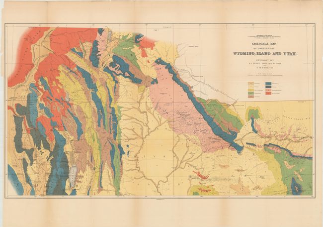
Publication: Hayden's 12th Annual Report
Color: Printed Color
Size:
36.3 x 20.4 inches
92.2 x 51.8 cm
This map was issued in Hayden's 12th Annual Report for 1879 but not published until 1883. It is a handsome and colorful map that largely covers part of Idaho eastward to the Sweetwater Range. Topography and hydrology are nicely developed and an abundance of towns and villages are shown. Bear Lake is at lower left bordering Idaho and Utah, Rawlings is at lower right with a portion of the Union Pacific Railroad detailed. Locates wagon roads, trails, sand dunes, and has fine watershed details. Mining activity is clearly shown in place names like Miner's Delight, Camp Stambaugh, Atlantic City, etc. It locates Blackfoot, Rose Fork Agency (Fort Hall), John Gray's Lake, Caribou, the Wind River or Shoshone Reservation, and much more. Taylor's Bridge on the Snake River pre-dates Idaho Falls.
References: Wheat (TMW) #1296.
Condition: B+
Issued folding with several minor fold separations and edge tears that just enter the image that have been closed on verso with archival materials. There is light toning along a few folds.