Subject: Western United States
Period: 1876-79 (dated)
Publication:
Color: Printed Color
Size:
22.2 x 17.4 inches
56.4 x 44.2 cm
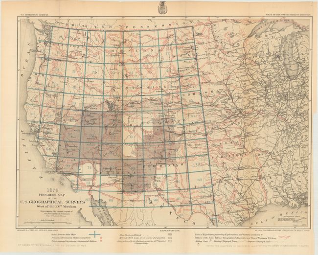
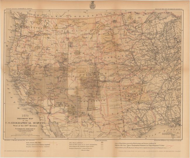
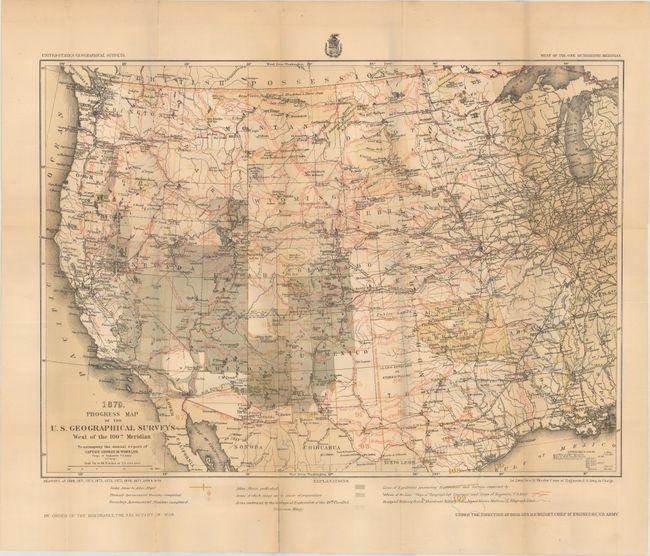
The 1870s was a period of intense effort, by such prominent people as Clarence King, Ferdinand Hayden, and John Wesley Powell, to advance the geographical knowledge of the West. These various surveys presented a threat to the Army's supremacy in the field of mapping and to the related appropriations from Congress. As a result of these pressures, the Army Corp of Engineers developed a plan to systematically survey the entire West to be called the U.S. Geographical Surveys West of the One Hundredth Meridian. The region was divided up into 95 rectangles, with atlas sheets to be prepared for each, comprising an area 2°45' of longitude and 1°40' of latitude on a scale of eight miles to the inch. Lieutenant George Wheeler was chosen to head this immense project. Surveys were conducted each summer from 1872 to 1878, after which Congress cut off appropriations for field work; thus the survey was not completed as originally envisioned. Wheeler published annual reports from 1873 to 1884, as well as the final Geographical Report published in 1889. The maps from this report are a valuable document of the record of Western exploration.
A nice set of maps that reflect the survey efforts in the West, The first covers the seasons of 1869 and 1871-75, while the latter two add the 1876-79 seasons. Each is a detailed representation of the various routes of western expeditions and the important surveys of King (40th parallel), Wheeler, Powell and Hayden. Among the many details are the locations of occupied and abandoned posts, astronomical stations, signal service stations, telegraphic lines, and the routes of cattle droves and trains. The progress maps are among the most interesting, informative and useful maps of the West.
References:
Condition: B+
Issued folding with light toning on the 1878 map. The 1879 map has a few fold separations mostly in the bottom blank margin repaired on verso with cello tape.