Catalog Archive
Auction 166, Lot 177

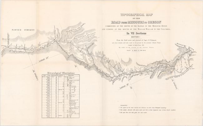
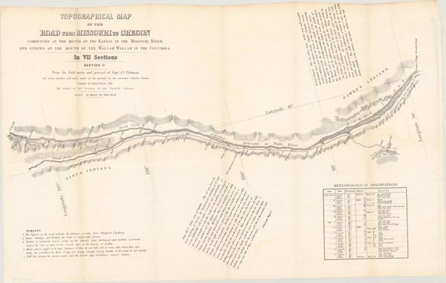
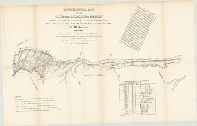
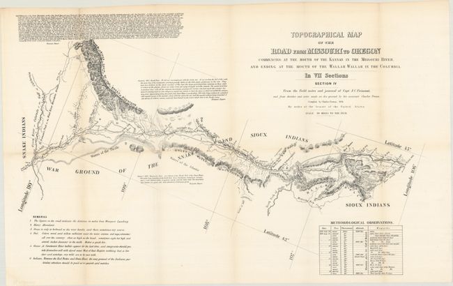
Scarce Seven-Part Oregon Trail Map

"[Lot of 7] Topographical Map of the Road from Missouri to Oregon Commencing at the Mouth of the Kansas in the Missouri River, and Ending at the Mouth of the Wallah Wallah in the Columbia. In VII Sections...", Fremont/Preuss

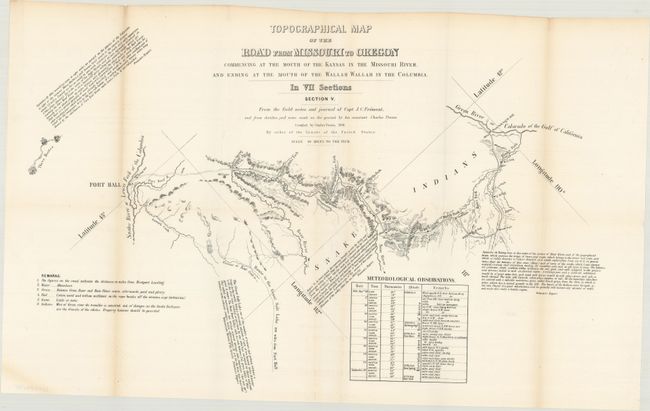
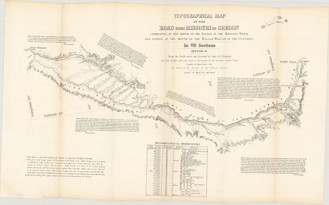
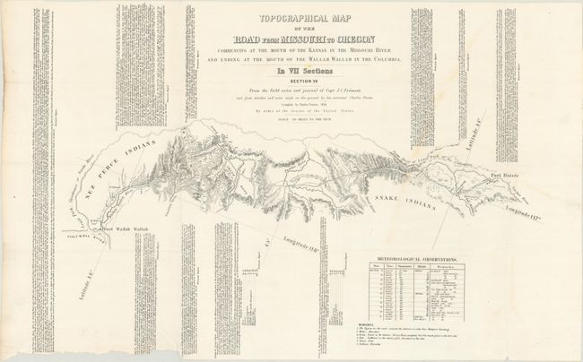
Subject: Western United States

Period: 1846 (dated)

Publication: HR Report 145, 30th Congress, 2nd Session

Color: Black & White

Size:
24.5 x 13 inches
62.2 x 33 cm
Download High Resolution Image
(or just click on image to launch the Zoom viewer)

John C. Fremont is an important historical figure best remembered for his three explorations of the west in the 1840s. Fremont married Jessie Benton, daughter of Sen. Thomas Hart Benton in 1841. The Senator championed the idea of Manifest Destiny, pushing for national surveys of the West and arranging for his son-in-law to lead them.

From 1842 to 1846 Fremont led three explorations of the west with Kit Carson as guide and Charles Preuss as the topographer. His early route became know as the Oregon Trail and his explorations are credited with encouraging the huge overland migration to the west. He was the first American to see Lake Tahoe, and finally determined that the Great Basin is endorheic, or closed basin with no outlet to the sea.

Fremont went on to become a millionaire, a California senator, a governor to Arizona Territory, the man who is credited with saving Kit Carson's life, and much more, yet died penniless and in virtual obscurity. Some scholars regard Fremont as a hero of significant accomplishment, while others view him as a failure who repeatedly defeated his own best ideals. He remains an enigmatic figure in the history of the United States. Read more of his fascinating story here.

This historic set of maps was compiled by Charles Preuss during Fremont's controversial Third Expedition. Preuss created this rare seven-part map from Fremont's map of 1845 with additional topography not included on the parent map. He used Fremont's sketches and notes as well as his own expedition notes. Wheat calls this set of maps a rarity that is important in the "evolution of the transcontinental wagon roads" and deserves "close study." Wheat devotes four pages to describe the maps and illustrates all seven in his monumental work. Each map is approximately the size given. Together the seven cover the region "commencing at the Mouth of the Kansas in the Missouri River, and Ending at the Mouth of the Wallah Wallah in the Columbia" - thus the Oregon Trail Route. Each sheet contains fascinating comments from Fremont's narrative, and notes regarding water, grass, fuel, game and Indians; invaluable information for emigrants at the time.

The map was originally published as a public document by order of the Senate in 1846, here reissued for the House of Representatives in 1849. The original Senate version includes the attribution to E. Weber & Co. directly below the title, while the 1849 edition has this removed. Also unique to this 1849 set is the fact that sheet III and sheet IV were accidentally reversed, so chronologically the sheet order should be 1,2, 6, 4, 5, 3, 7 (the images are ordered to show this correct progression).

References: cf. Wheat (TMW) #523; cf. Streeter Sale #3100.

Condition: B+

Issued folding with a bit of light toning along the left fold and an occasional tiny split at a fold intersection. Sheet 7 has a chip and closed edge tear at bottom left that only impacts a small portion of the text. The first six sheets should be considered "A" condition and the seventh sheet is a "B".

Estimate: $3,250 - $4,000

Sold for: $2,000

Closed on 2/14/2018

Archived