Subject: Colonial Southern United States
Period: 1783 (circa)
Publication: Atlas de Toutes les Parties Connues du Globe Terrestre
Color: Hand Color
Size:
8.4 x 12.7 inches
21.3 x 32.3 cm
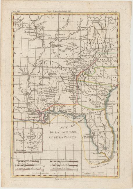
This handsome map of the American Southeast and the Mississippi River Valley extends from Charleston, South Carolina west to include New Orleans and north into southern Illinois. In this French-produced map Louisiana extends to the Appalachian Mountains bordering the southern colonies. The Mississippi and Ohio Rivers are well delineated. Florida is shown with its panhandle extending west to include Mobile and Biloxi. Locates Charles Town, Savannah, St. Augustine, Mobile, Pensacola, and several far western settlements and forts in the frontier. A small inset provides details of the Missouri River. Six distance scales fill the Gulf of Mexico. Engraved by Andre.
References:
Condition: B+
A clean, bright example on watermarked paper with several worm tracks at right that have been professionally infilled, and a tear at bottom right that has also been archivally repaired.