Catalog Archive
Auction 166, Lot 157

"An Exact Map of North and South Carolina, & Georgia, with East and West Florida. From the Latest Discoveries", Lodge, John

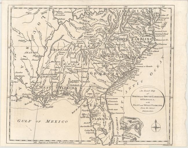
Subject: Colonial Southeastern United States

Period: 1778 (circa)

Publication: William Russell's The History of America…

Color: Black & White

Size:
10 x 8.5 inches
25.4 x 21.6 cm
Download High Resolution Image
(or just click on image to launch the Zoom viewer)

This uncommon map shows the southeastern colonies, from Virginia and Maryland south to Florida and west to Louisiana. Several Native American tribes are noted, including the Catawbas, Chicasaws, Chactaws and Cherakees. The map extends to include the northern part of the Bahamas. It was included in Russell's history that included an "Appendix Containing an Account of the Rise and Progress of the Present Unhappy Contest Between Great Britain and her Colonies" - an interesting label for the American Revolution!

References: Howes #R539.

Condition: A

A dark impression on a clean sheet with a bit of faint offsetting at lower left from an opposing page of text. Issued folding.

Estimate: $450 - $550

Sold for: $275

Closed on 2/14/2018

Archived