Subject: Colonial Southeastern United States
Period: 1643 (circa)
Publication: Theatre du Monde ou Nouvel Atlas
Color: Hand Color
Size:
19.8 x 15.2 inches
50.3 x 38.6 cm
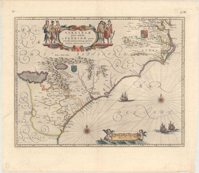
This lovely map of the Southeast extends from the southern part of Chesapeake Bay to northern Florida. Cartographically it improves on the Hondius map of 1606, on which it was derived, with the Chesapeake Bay correctly indicated as a large bay and the Carolinas and Georgian coasts depicted more accurately. The map presents the English and French colonial interests in the region as depicted by their respective royal arms. At the southern end of the Appalachians is a note concerning gold and silver mines. Richly decorated with a large cartouche flanked by Native Americans. The Atlantic Ocean contains two compass roses, three sailing ships and two aquatic putti holding the German scale of miles. This is the second state of the map with French text on verso, published between 1643-50.
References: Burden #253; Van der Krogt (Vol. II) #9400:2.
Condition: A
A dark impression with full, original color on watermarked paper. There is light printer's ink residue and a couple of small rust spots that do not distract.