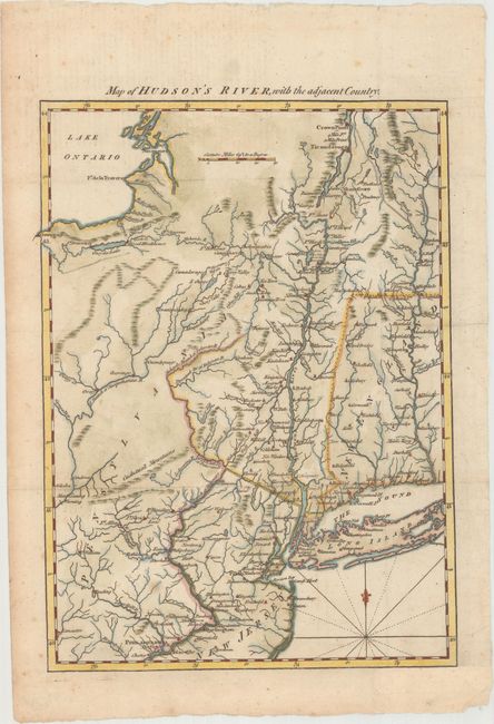
Subject: Colonial New England United States, Revolutionary War
Period: 1778 (published)
Publication: Gentleman's Magazine
Color: Hand Color
Size:
8.5 x 11.6 inches
21.6 x 29.5 cm
This strongly engraved Revolutionary War map was designed to familiarize the magazine's readers with the location of the hostilities in the American War. It illustrates the region of the Hudson and Delaware Rivers and the marches of the armies under the Generals Howe, Clinton, and Burgoyne. It covers New York and New England as far east as the Connecticut River, south to include Philadelphia, and north to encompass Crown Point and Ticonderoga.
References: Jolly #GENT-257.
Condition: B+
Issued folding, now flattened, with very minor toning, a hint of offsetting, and a few small spots of foxing. A binding trim at bottom has been professionally replaced with period-correct paper.