Subject: Eastern United States, Texas
Period: 1844 (dated)
Publication:
Color: Hand Color
Size:
79 x 63 inches
200.7 x 160 cm
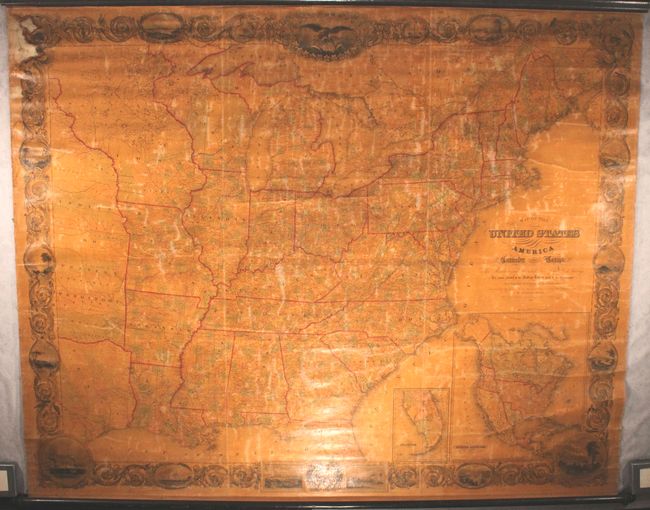
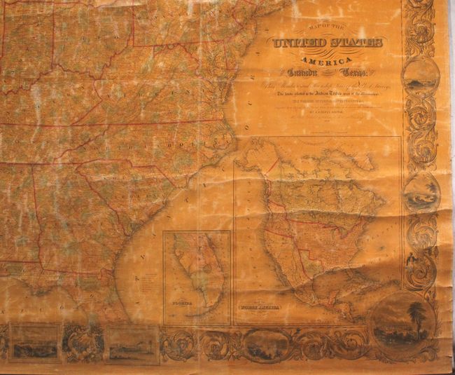
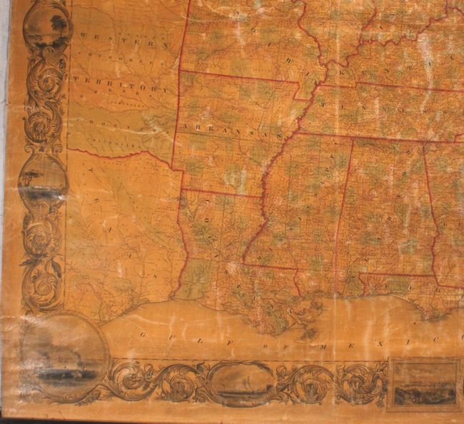
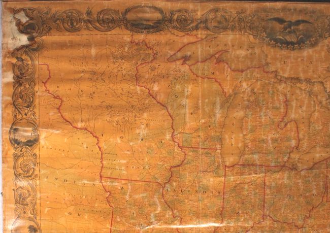
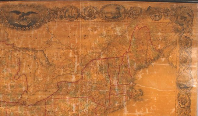
This enormous wall map measures nearly 7 feet long and over 5 feet wide and was printed on nine sheets. It was lauded at the time as one of the largest and most detailed maps of the United States ever published. The map extends from the Atlantic seaboard west to Fort Pierre (South Dakota) and south to Austin in the independent Republic of Texas. The western frontier consists of a large Indian or Western Territory that covers portions of present-day Oklahoma, Kansas and Nebraska, as well as a large Iowa Territory that includes present-day western Minnesota and the Dakotas. Wisconsin Territory includes eastern Minnesota. The frontier is dominated by Indian tribes including the Mandans, Pawnees, Shawnees, Osage, Cherokees, and Creek to name a few. A large area in Iowa Territory is labeled "Neutral Ground", which was a 40 mile by 200 mile stretch of land intended to keep the Sauk and Fox tribes from warring with the Sioux and Dakota tribes. The map shows county boundaries, the status of township surveys, as well as proposed/completed railroads, roads and canals. Includes inset maps of Southern Florida and North America, which prominently depicts an Independent Texas in its largest configuration extending into present-day Colorado. The map is surrounded by a decorative border and a series of vignettes featuring important cities including New York, Philadelphia, Washington, and New Orleans. Engraved by Sherman & Smith.
John Calvin Smith published this map in both case and wall map format beginning in 1843, making this the second edition, with further editions running until 1852. The Colton firm would take over the publication of this map, with known editions in 1854 and 1857.
References: Phillips (Maps) p. 896; Wheat (TMW) #471 (inset); Ristow p. 318.
Condition: B
The map is lightly toned due to the varnish, along with minor cracking and more widespread surface abrasions. There is a dampstain at top left that is confined to the decorative border. Given its large size, the map is in remarkably good condition and better than we typically see.