Subject: Eastern United States
Period: 1794 (dated)
Publication: An Historical, Geographical, Commercial, and Philosophical View of the American United States
Color: Black & White
Size:
18.4 x 14.5 inches
46.7 x 36.8 cm
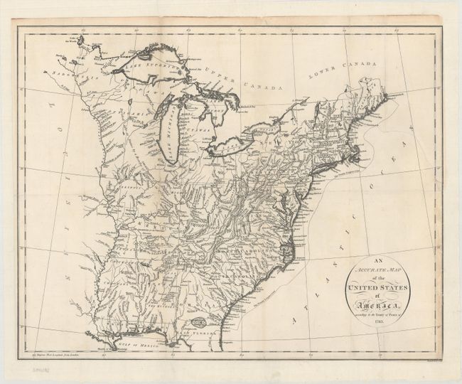
This is a very early map of the young United States that details the states, new territories, and the Indian lands east of the Mississippi River. The Western Territories include several Bounty Land Grants including Colonel Simmers, Army Land, Ohio Company, and Donation Lands from the Commonwealth of Virginia, Illinois Company, Wabash Company, and New Jersey Company. The area northeast of the Mississippi River is largely unorganized and denoted as "Divided into 10 States by a Resolve of Congress in 1784." A large section of Kentucky is Land Reserved for the Virginia Troops. The newly formed Tennessee Government is outlined with a large section Reserved for the N. Carolina Troops. Georgia extends to the Mississippi River. Various Indian tribes and forts are indicated throughout. The Twenty Leagues Line is drawn in the Atlantic.
References: McCorkle #794.14; Phillips (A) #1363-4.
Condition: B
On a bright sheet that is issued folding and now flattened and backed with heavy tissue to reinforce and repair a long separation along the left fold and a 3.5" binding tear at right. Trimmed to the neatline at bottom and right with several minor fold separations along the top edge of the sheet.