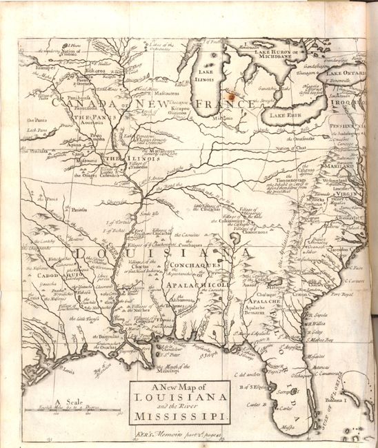
Subject: Colonial Eastern United States
Period: 1726 (published)
Publication:
Color: Black & White
Size:
9 x 10.2 inches
22.9 x 25.9 cm
This interesting map focuses on the French empire in the heart of North America, embracing both the Great Lakes and the Mississippi Valley. It illustrates the French threat to the British colonies that are confined along the Atlantic seaboard by the Appalachian Mountains. French trading posts, lead mines, trails, and Indian villages are carefully noted and the Indian nations are prominently named. The Missouri River emanates from a great lake in the northwest that disappears off the map and another Great River flows west from Lack Pani; both alluding to the possibility of a passage to the Pacific.
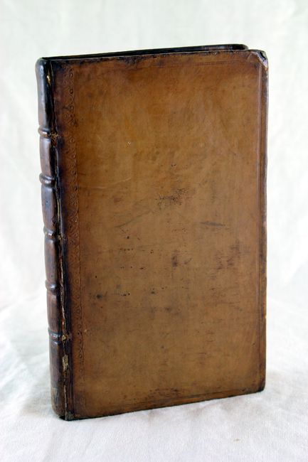
This map is bound in The Memoirs and Secret Negotiations of John Ker published by Edmund Curll. This is volume two of a three-volume set, focusing primarily on the French Possessions in America and the negotiations with Ker, a British spy. 184 pp. with an index. Contemporary full calf with raised bands on the spine.
References: Howes #K101; cf. Cumming (SE) #176.
Condition: B+
There is a small rust spot in the map near the Great Lakes and a binding trim at lower right with an associated tiny binding tear. Book pages are tight and mostly clean. The hinge is broken but the boards are in good condition and still intact.