Subject: United States, Railroads
Period: 1878 (circa)
Publication:
Color: Black & White
Size:
29.9 x 19.9 inches
75.9 x 50.5 cm
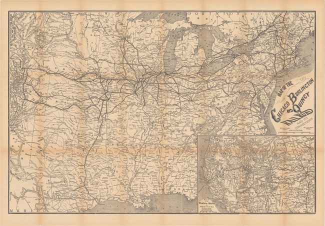
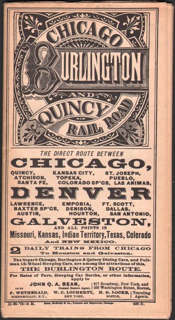
This is an early folding map and timetable for the Chicago Burlington & Quincy Railroad system, dated in the winter of 1878. The large map shows the route and connecting lines centered on Chicago, extending to Bangor and Quebec and westward to Denver and south to Dallas, Houston, San Antonio and Galveston. Each railroad is named with hundreds of rail stations located and likewise named. At lower right is the large "Map of the Western States and Territories" which extends to Olympia, Portland, San Francisco, Los Angeles, and Fort Yuma. It also provides great detail of the intrastate railroad system of California. This great piece of railroad ephemera has an extensive timetable on the verso of the map. The various panels also advertise Dining Cars by the Pullman Company, information for emigrants plus two illustrated panels recommending "Elegant Dining Cars Which are run ONLY via the Burlington Route" and "Pullman's Drawing Room and Sleeping Coach." Self folds into 4" x 7.25" brochure with fancy logo for the railroad at top.
References:
Condition: B
Issued folding with light toning along the folds and a number of separations at the fold junctions.