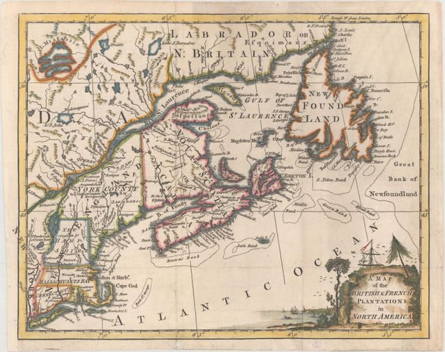
Subject: Colonial New England & Canada
Period: 1755 (published)
Publication: London Magazine
Color: Hand Color
Size:
10.5 x 8.2 inches
26.7 x 20.8 cm
This charming little map of New England and northeastern Canada covers from Long Island through the coast of Labrador. New England consists of Connecticut, Rhode Island, Massachusets Bay, New Hampshire and York County. The title cartouche was meant to serve as the title for three maps published in the July, August and September editions of the magazine. Together those maps covered the entire American theater of the Seven Years War or French and Indian War.
References: Jolly #LOND-96; Kershaw #351; McCorkle #755-28; Sellers & Van Ee #65.
Condition: B+
Issued folding, now flattened with light soiling, a few minor extraneous creases, and a binding trim at left that has been professionally replaced with period-correct paper.