Subject: Exploration & Surveys, Northwestern North America
Period: 1831 (published)
Publication:
Color: Black & White
Size:
5.6 x 8.8 inches
14.2 x 22.4 cm
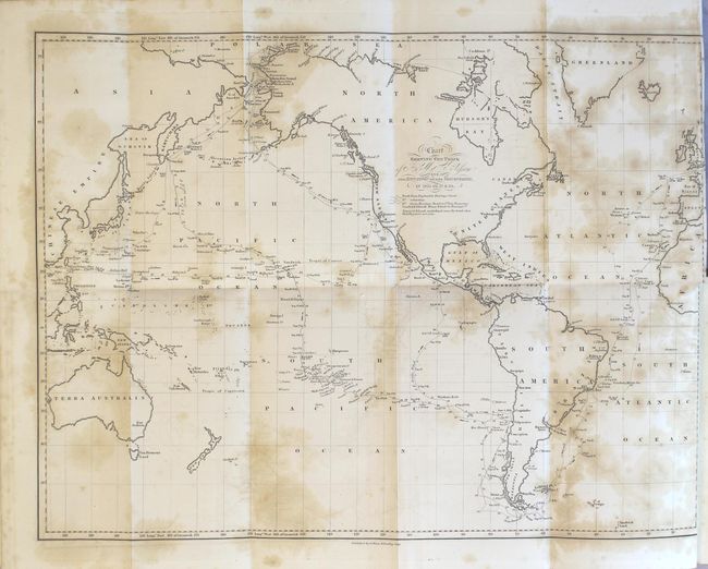
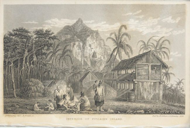
This is Beechey's important account of his exploration of the northwest coast of North America, which Sabin describes as "one of the most valuable of modern voyages, containing a most interesting visit to Pitcairn's Island, the coast of California, etc..." Howes describes it as "interesting accounts of Monterey and San Francisco before the American conquest." Frederick William Beechey was appointed to command the HMS Blossom in 1825 after serving under Lieutenant John Franklin and Lieutenant William Parry. In addition to his surveying around the Bering Strait, he named Point Barrow (in present-day Alaska where he was supposed to rendezvous with John Franklin), discovered a harbor near Cape Prince of Wales, and found a number of islands in the Pacific Ocean. This volume contains 21 plates and three maps. The two large folding maps are:
A. Chart Shewing the Track of H.M.S. Blossom, and the Situation of Her Discoveries, in 1825-26-27 & 28 (19.2 x 14.3"). Shows the path of Beechey's expedition from England to Alaska with stops in the Society Islands, Hawaiian Islands, San Francisco Bay, Kamtschatka, Bering Strait, and Barrow. Detail is confined to the coastline. A note below the title indicates that the "names of the islands underlines near the track shew that they were not seen."
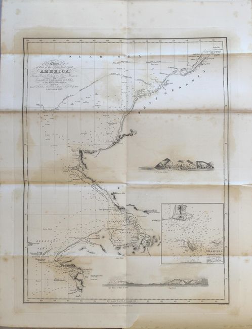
B. Chart of Part of the North West Coast of America, from Point Rodney to Point Barrow... (13.1 x 17.3"). Features good detail from the Bering Strait to Barrow with numerous soundings, shoals and notations along the coast. The packed ice lines are identified as of August 1826 and 1827, and above Barrow is "Packed Ice as far as could be seen." Includes an inset of Kotzebue Sound and two approach views.
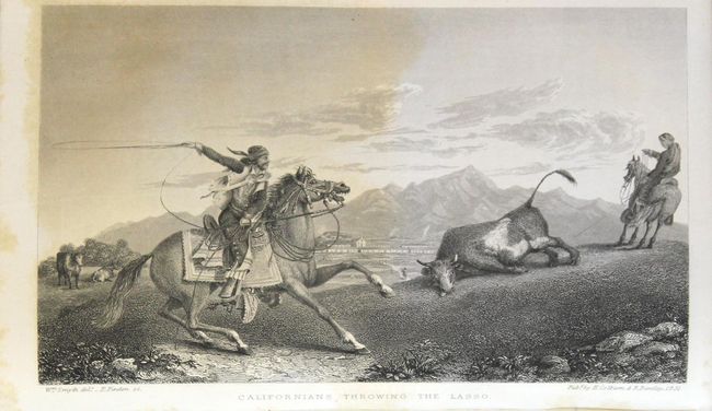
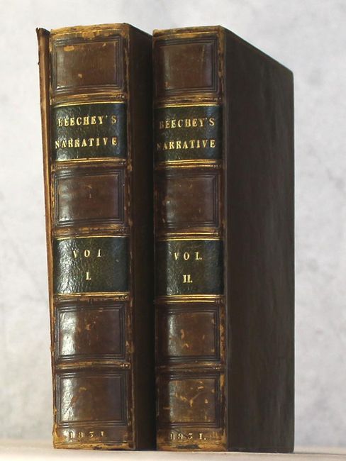
Volume 1 (472 pages) and volume 2 (452 pages) with a fascinating plate entitled "Californians Throwing the Lasso." Hardbound in full leather with gilt title and raised bands on spine.
References: Howes #B309; Sabin #4347; Streeter Sale #3517.
Condition: B+
The maps have scattered foxing and offsetting, with the large chart of the tracks of the H.M.S Blossom having a 1" binding tear at right. The text is clean and bright and the plates have occasional foxing. Extremities have light shelf wear.