Subject: Western Europe
Period: 1758 (circa)
Publication: Atlas Minimus
Color:
Size:
2.5 x 3.7 inches
6.4 x 9.4 cm
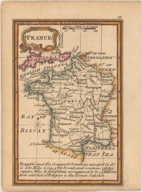
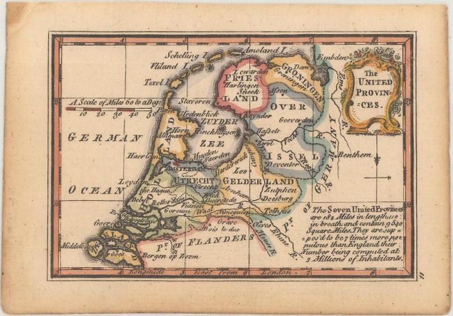
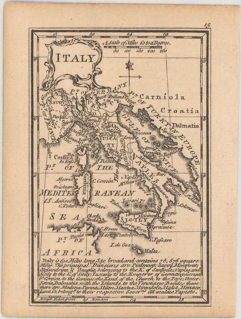
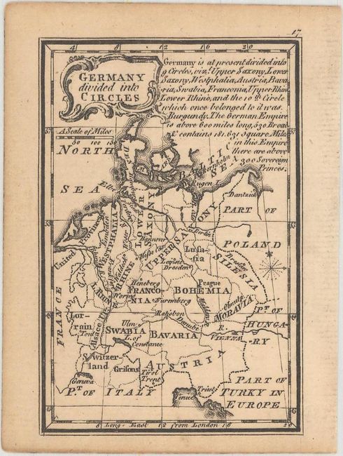
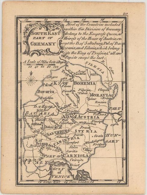
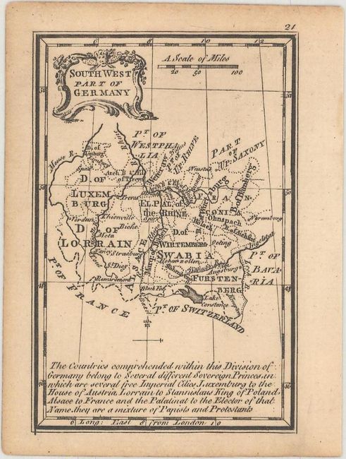
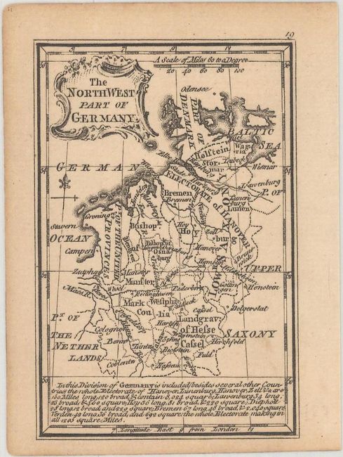
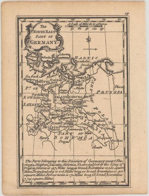
This set of miniature maps appeared in Atlas Minimus, a pocket atlas containing 52 maps, drawn and engraved by John Gibson, with revisions by Emmanuel Bowen, and published by John Newbery. The atlas was considered one of the most attractive miniature atlases of the 18th century. Included in this set are maps of France, the Netherlands, Italy, and 5 regional maps of Germany. Each map focuses on political boundaries, major rivers, and key cities, and includes a note with descriptive information about the region.
A. France, hand color.
B. The United Provinces, hand color.
C. Italy, black & white.
D. Germany Divided Into Circles, black & white.
E. South East Part of Germany, black & white.
F. South West Part of Germany, black & white.
G. The North West Part of Germany, black & white.
H. The North East Part of Germany, black & white.
References: King (2nd Ed.) p. 172.
Condition: A
Minor toning. A few maps have small stains in the blank margins, and the map of Italy has remnants of hinge tape on verso.