Catalog Archive
Auction 165, Lot 408

NO RESERVE

"A General Chart of the Western Ocean", Mount & Page

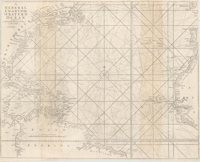
Subject: North Atlantic

Period: 1760 (circa)

Publication: The English Pilot The Fourth Book

Color: Black & White

Size:
22.9 x 18.3 inches
58.2 x 46.5 cm
Download High Resolution Image
(or just click on image to launch the Zoom viewer)

Handsome and scarce sea chart of the North Atlantic covering the coastlines from Newfoundland to Wild Brazile, and from Ireland to Guinea. Fine coastal detail including the fishing banks off Newfoundland and the shoals and reefs of the Caribbean. Decorated with a compass rose and rhumb lines. This chart was published by Mount & Page in numerous editions of The English Pilot The Fourth Book between 1721-73, and was based on a chart by John Sellers published in 1675.

References: Pritchard & Taliaferro #40.

Condition: B

Margins trimmed to neatlines and impression is a bit uneven. There are light vertical stains at right and left.

Estimate: $300 - $400

Sold for: $210

Closed on 11/15/2017

Archived