Subject: Gulf of Mexico & Caribbean
Period: 1780 (published)
Publication:
Color: Black & White
Size:
19.1 x 12.4 inches
48.5 x 31.5 cm
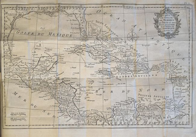
This is volume one (of four) from the second French edition of William Robertson's History of America. The volume is divided into four books and covers the history of navigation, Columbus' voyages to the New World, early colonization in the Caribbean and Florida, and a description of America and its inhabitants. Bound into the volume is Kitchin's map of the Gulf of Mexico, here entitled Carte du Golfe du Mexique, des Isles et des Pays Adjacens pour l'Histoire de l'Amerique. Cartographically, the map covers the region from Florida and the Gulf coast to northern South America. The southern portion of Florida is fragmented into numerous waterways. There is crisp detail of the many islands, the South American coast and Central America. Engraved by Benard. 12mo., hardbound in full leather with gilt title and decorations on spine.
References: Howes #R358; Sabin #71990.
Condition: B+
The map has light offsetting, minor scattered foxing, and a 1" binding tear at left. Text is tight with light scattered foxing. The hinges are starting with light wear to the extremities.