Subject: Colonial Mid-Atlantic United States
Period: 1676 (circa)
Publication:
Color: Hand Color
Size:
19.7 x 14.9 inches
50 x 37.8 cm
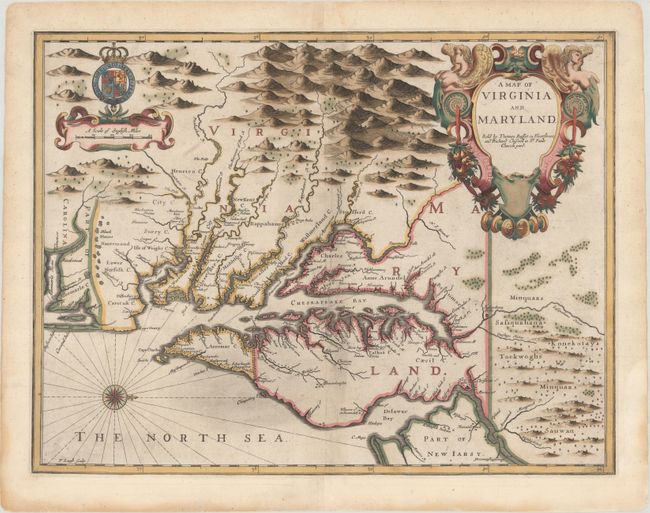
This highly sought-after and decorative map was engraved by Francis Lamb. Oriented with north to the right, the map shows both the Chesapeake and Delaware Bays and Part of New Iarsy. Following John Smith's general outline, Lamb draws upon Augustine Herrman's landmark map for improved geography and English nomenclature, as well as its depiction of the Delaware Bay and River. The boundary between Virginia and Maryland on the eastern shore, settled in 1688, is depicted with the Herrman-like usage of a double line of trees. The map is beautifully decorated with the Royal Arms of England and a large elegant title cartouche. First state with the imprint of Bassett and Chiswell. Very rare edition with blank verso; although most examples of this map were published with English text on verso in Speed's A Prospect of the Most Famous Parts of the World beginning in 1676, some examples were issued separately without text.
References: Burden #456; Goss (NA) #40; Tooley (Amer) p.170, Derivative 9, state 1; Shirley (BL Atlases) T.SPE-2f #23.
Condition: B+
A nice impression on paper with a bunch of grapes watermark and light printer's ink residue. The map has been expertly remargined with period paper.