Subject: History Books
Period: 1737 (published)
Publication:
Color: Black & White
Size:
7.8 x 9.8 inches
19.8 x 24.9 cm
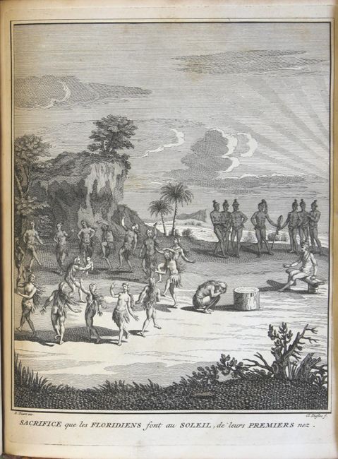
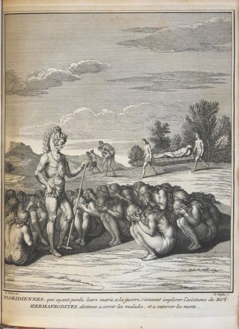
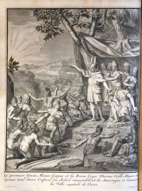
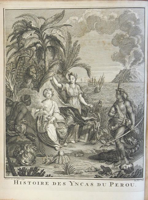
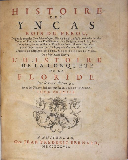
This two volume set is the French translation of Lasso de la Vega's "History of the Inca Kings of Peru" (Volume 1) and "History of the Conquest of Florida" (Volume 2). This second volume also contains Hennepin's "A New Discovery Of A Vast Country in America." The volumes feature 14 beautiful plates of native scenes by Picart, and two of the three issued folding maps (missing Carte du Voiage du P. Hennepin in Volume 2) including:
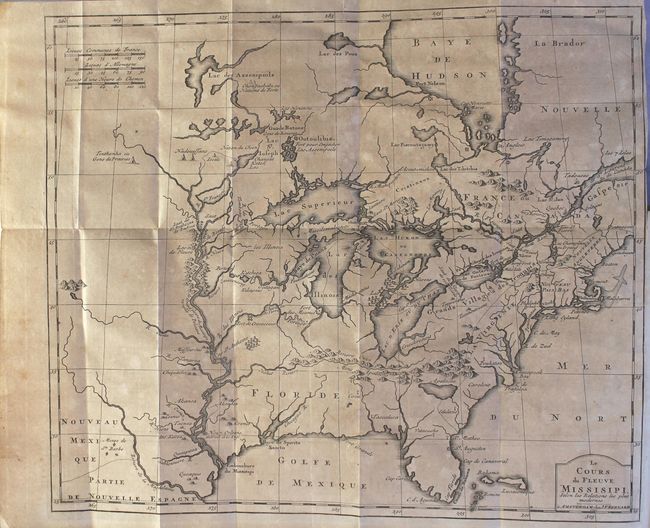
Le Cours du Fleuve Missisipi Selon les Relations les Plus Modernes (17.3 x 14.7"). This early map is based upon Louis Hennepin's seminal map of the Mississippi River and the Great Lakes. Hennepin's map presented a marked improvement on Sanson's depiction of the lake routes into the interior and the Great Lakes region, particularly the delineation of Lakes Superior, Michigan and Huron. Even with these improvements, the lack of accuracy is very evident; depicting the lakes enlarged and exaggerated, Hudson Bay too far to the east and the Mississippi River too far to the west with its mouth in what is present day Texas. The spurious lake described by LeMoyne is depicted just south of the Appalachians. A number of early settlements and Indian Tribes are shown around the Great Lakes and along the Mississippi and this map has been updated to show the location of New Orleans. References: McCorkle #737.1; Goss #46. Condition: Light to moderate toning. (B)
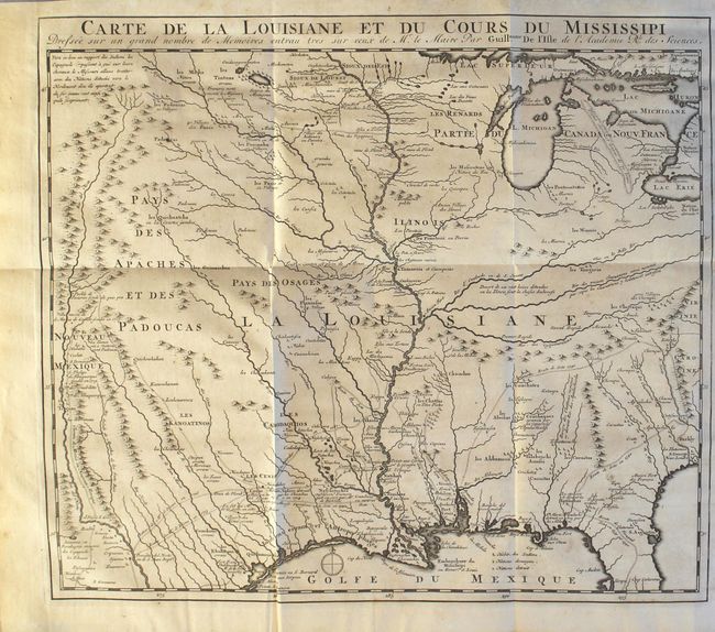
Carte de la Louisiane et du Cours du Mississipi (15.5 x 13.9"). This is a reduced-size edition of Delisle's influential map of the French possession of Louisiana that drew together the cartographic work of the previous half century and had a tremendous impact on the history of cartography. When originally published in 1718, it was the first detailed map of the Gulf region and the Mississippi, and the first to show the explorations of De Soto, Cavelier, Tonty, Moscoso and Denis. The map was designed for the political purpose of invalidating the English claims west of the Appalachian Mountains and laid claim to Carolina by the French, which provoked an angry English response. The name Texas made its first appearance in print on the earlier edition of this map, with the legendary Mission de los Teijas, established in 1716. References: Cumming (SE) #175; Tooley (Amer) p. 22, #44. Condition: There is a very short binding tear that enters the right border, light offsetting, and a few tiny spots of foxing. (B+)
Volume 1 (540 pages) with 9 plates and 1 folding map. Volume 2 (373 pages) with five plates (one folding) and 1 folding map. Quarto, hardbound in full original leather with raised bands and gilt titling on spine.
References: Sabin #98752.
Condition: B+
See description above for details/grades on the maps. Plates and text are very good with pleasant light toning and an occasional spot of foxing. There are previous owners' bookplates on pastedowns of both volumes. The joints are cracking, but both the head and tail of spine have been reinforced with leather under the original spine label. Covers are rubbed with some abrasions, and the edges have also been reinforced with leather.