Subject: Exploration & Surveys
Period: 1842 (published)
Publication:
Color: Black & White
Size:
4 x 6.3 inches
10.2 x 16 cm
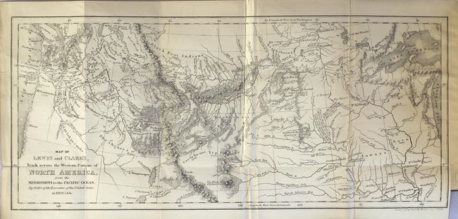
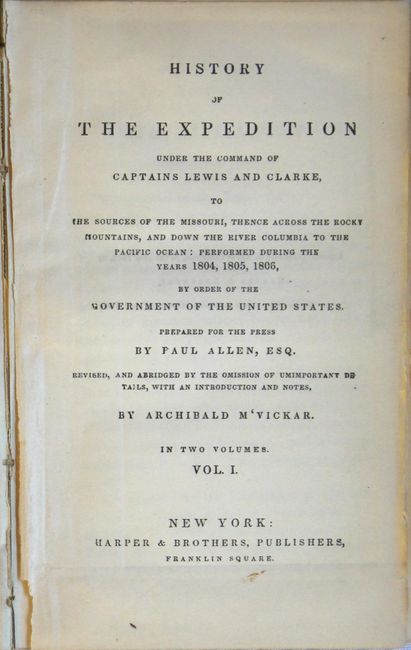
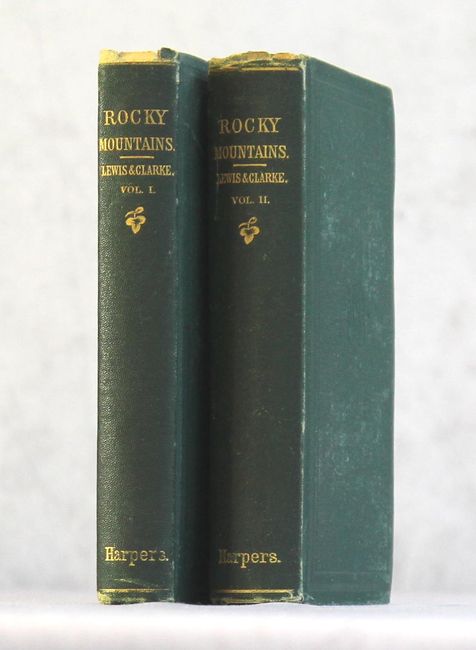
This is a later edition of Harper and Brothers' abridged two volume set that documents the monumental efforts of Lewis and Clark on their trek across the northwestern United States. Bound into the front of Volume I is a folding map, which is a reduced version compiled by William Clark in 1814, entitled Map of Lewis and Clark's, Track Across the Western Portion of North America, from the Mississippi to the Pacific Ocean.... The map is incredibly accurate and filled with extensive notes concerning the epic expedition. This edition is without the five additional plates found in earlier publications. Volume I consists of 371 pages and volume II has 395 pages. 16mo. Both volumes are hardbound in their original green cloth covers with gilt titling on the spines.
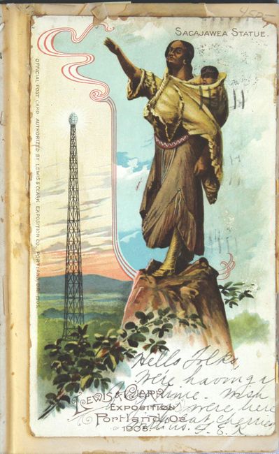
This example includes a postcard pasted onto the front free-endpaper from the Lewis & Clark Exposition held in Portland, Oregon in 1905 (see images). The postcard prominently features the Sacajawea Statue, which was commissioned for the Exposition and located in Washington Park.
References: Howes #L317; Sabin #40833.
Condition: B
The map is lightly toned with numerous fold separations that have been repaired on verso with archival tape. Text is lightly toned with one small pencil notation in the introduction (page 23). A postcard from the Lewis & Clark Exposition is pasted onto the front free endpaper of volume 1. Covers and spine show light wear and the edges are bumped.