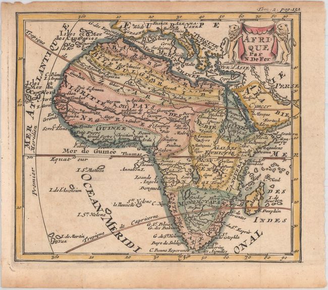
Subject: Africa
Period: 1704 (published)
Publication: Methode pour Apprendre Facilement la Geographie
Color: Hand Color
Size:
6.3 x 5.4 inches
16 x 13.7 cm
This handsome small map of Africa is filled with spurious cartography, including a depiction of the Nile River (Nils des Anciens) originating from the two Ptolemaic source lakes south of the equator. The source of the Blue Nile is correctly located at Lake Tana in East Africa and the Niger River is shown with its traditional source at Lac Niger just north of the equator. Two St. Helena islands still appear in the Atlantic Ocean. The map was prepared by De Fer and modeled after Pierre Duval's four-sheet map published in 1678. The drape-style title cartouche is flanked by a pair of lions. Published in M. Robbe's Methode pour Apprendre Facilement la Geographie.
References: Betz #142.2.
Condition: B+
Issued folding on watermarked paper with very light toning.