Catalog Archive
Auction 164, Lot 682

"Les Isles Philippines, Molucques et de la Sonde", Fer, Nicolas de

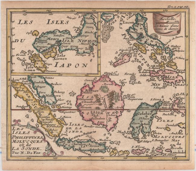
Subject: Indonesia, Philippines & Japan

Period: 1704 (published)

Publication: Methode pour Apprendre Facilement la Geographie

Color: Hand Color

Size:
6.8 x 5.6 inches
17.3 x 14.2 cm
Download High Resolution Image
(or just click on image to launch the Zoom viewer)

This is a very close copy of Nicolas de Fer's map of the islands of Indonesia and the Philippines with a particularly noteworthy inset map of Japan. The main map is primarily based on Sanson's important map of the same title. However the map of Japan shows various influences resulting in a unique shape. Shows the cities and smaller settlements, rivers, mountain chains, and even forests. The equator is marked and latitude and longitude indications are in the borders. Published in M. Robbe's Methode pour Apprendre Facilement la Geographie.

References: Walter #OAG-52.

Condition: B+

Very light toning and minor offsetting.

Estimate: $200 - $230

Sold for: $150

Closed on 9/13/2017

Archived