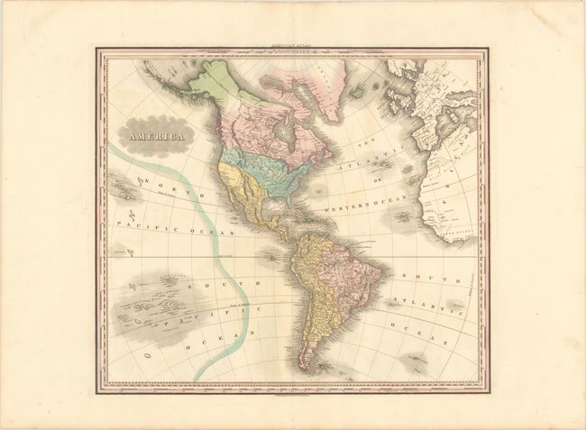
Subject: Western Hemisphere - America
Period: 1823 (circa)
Publication: American Atlas
Color: Hand Color
Size:
21.2 x 18.6 inches
53.8 x 47.2 cm
A handsome map that shows the Western Hemisphere from Cape Horn to Baffin Bay, and from the Sandwich Isles to the western fringes of Europe and Africa. In North America, the United States is shown with its current northern border until the Pacific Northwest at which point it shows neither United States nor British claims, as this region was jointly occupied during this period. Alaska is still largely unexplored while Mexico is in control of Texas and the Southwest. There is good detail of the islands in the South Pacific including the Dangerous Archipelago.
References:
Condition: A
Very good condition with original color. Very faint toning and offsetting, else fine. There is some creasing at top right, well away from the image.