Subject: Arabia & Central Asia
Period: 1598 (published)
Publication: Geografia Cioe Descrittione Universale della Terra...
Color: Hand Color
Size:
6.8 x 4.9 inches
17.3 x 12.4 cm
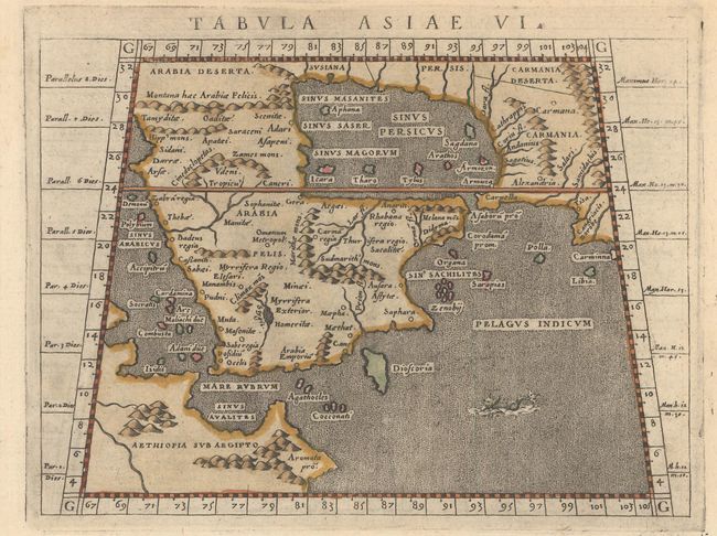
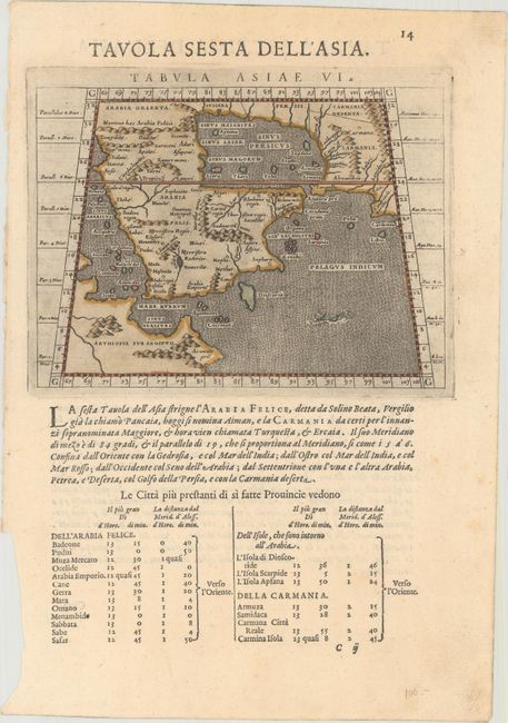
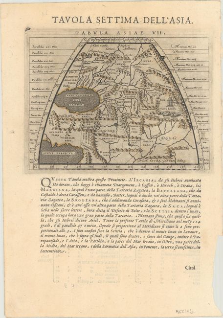
Claudius Ptolemy was a mathematician, astronomer and geographer who worked in Alexandria, then a part of the Roman Empire, in the 2nd century AD. One of the most learned and influential men of his time, his theories dominated both astronomy and geography for nearly 1500 years. His writings were kept alive by Arabic scholars during the Middle Ages and reemerged in Europe during the Renaissance. The birth of printing led to wide dissemination of his great works on astronomy and geography. There were a number of editions of his Geographia beginning in 1477. These early editions contained maps based on his original writings, known as Ptolemaic maps. As geographic knowledge increased with the explorations of Columbus, Magellan, Cabot and others, maps of the New World were added, and maps of the Old World were revised. Ptolemy's Geographia continued to be revised and published by some of the most important cartographers including Martin Waldseemuller, Sebastian Munster, Giacomo Gastaldi, Jodocus Hondius, and Gerard Mercator (whose last edition was published in 1730).
Finely engraved Ptolemaic map of Arabia with a stipple engraved sea and a tiny fanciful sea monster in the Pelagus Indicum. It is a fairly good representation of the peninsula, although Ptolemy overestimated the width of the southern part of the peninsula and distorted the shape of the Arabian Gulf. The map is presented on a trapezoidal projection with parallels and meridians (forerunners of lines of longitude and latitude) enumerated in the borders. Major towns are named, although not accurately located, and the rivers are entirely imaginary. Tabula Asiae VII, a map of Central Asia, is on verso. The maps are on a full sheet of Italian text (7.7 x 11.3").
References: Shirley (BL Atlases) T.PTOL-12b; Mickwitz & Miekkavaara #226-21 & #226-22.
Condition: A
Dark impressions with minor soiling and a small chip in the bottom left blank margin.