Subject: Mediterranean
Period: 1944 (dated)
Publication:
Color: Printed Color
Size:
57.1 x 38.2 inches
145 x 97 cm
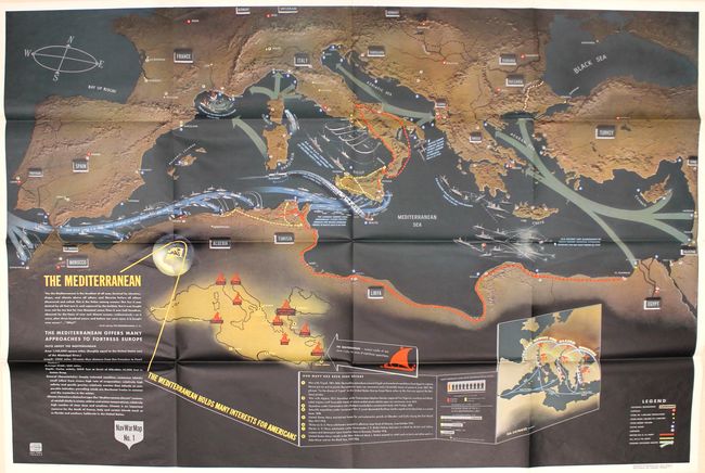
This very large pictorial map was produced by the Educational Services Section of the U.S. Navy. One of the division's primary goals was to inform American service members of the status of the war and to provide context for the battles they would be joining. The map is densely filled with illustrations and text with particular emphasis on the Allied fleet along the north African coast and the many islands in the Mediterranean including Sardinia, Malta, Sicily and Crete. An inset map filling the interior of Africa shows the sites of past wars in the Mediterranean with the note "Our Navy Has Been Here Before." A second inset shows the extended range of Allied Bombers into mainland Europe. A legend at bottom right identifies naval bases, airfields, British Army lines, U.S. Army lines, and possible invasion routes. A vivid depiction of the events in the Mediterranean theater of war.
References: Curtis & Pedersen (War Map) pp. 184-187.
Condition: A+
Mint condition with vivid color.