Catalog Archive
Auction 164, Lot 612

"Plan du Port et de la Baye de Tarante...", Ayrouard, Jacques

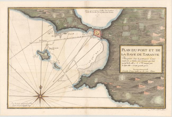
Subject: Taranto, Italy

Period: 1732 (circa)

Publication: Recueil de Plusieurs Plans des Ports ... de la Mer Mediterranee

Color: Hand Color

Size:
17.8 x 11.5 inches
45.2 x 29.2 cm
Download High Resolution Image
(or just click on image to launch the Zoom viewer)

This chart depicts the fortified city of Taranto between the "Little Sea" and the "Big Sea" leading to the Ionian Sea. Depth soundings are given in the Big Sea and there are a few navigational notes as well. Created by Jacques Ayrouard and engraved by Louis Corne. Surprising little is known about Jacques Ayrouard and he only published this single book on the ports in the Mediterranean. He was a navigator for the French Royal Navy and dedicated his work to Jean Frederick Phelypeaux Comte de Maurepas, who was the Minister of the Navy to Louis XV.

References: Shirley (BL Atlases) M.AYR-1a.

Condition: B+

Light offsetting.

Estimate: $190 - $220

Unsold

Closed on 9/13/2017

Archived