Subject: Western Hemisphere - America
Period: 1783 (dated)
Publication: Atlas Moderne
Color: Hand Color
Size:
17.6 x 12 inches
44.7 x 30.5 cm
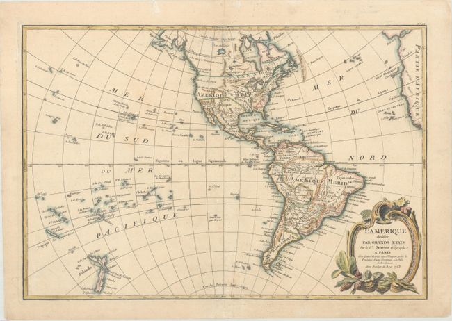
This is a later edition of this copper engraved map of the Americas. When originally engraved, the map included a large Sea of the West and hints of a possible Northwest Passage. It has been re-engraved to delete those features (although they can still be faintly discerned). Alaska now is shown with approximately the correct shape, although the Aleutians are missing. The Sandwich Islands (Hawaii) are prominently shown and noted as the site of Capt. Cook's death. New Zealand is fully formed and there are many islands shown in the South Pacific. The map shows the infant United States with its western boundary on the Mississippi River. Spain controls all of the Southwest, Midwest and Florida, and Britain possesses Canada and the Pacific Northwest.
References:
Condition: B+
A nice impression on watermarked paper with two tiny holes along the centerfold at top that have been archivally repaired. There is very light soiling and a hint of toning.