Subject: Northeastern France
Period: 1635 (circa)
Publication: Historia Mundi or Mercators Atlas...
Color: Hand Color
Size:
7.2 x 5.2 inches
18.3 x 13.2 cm
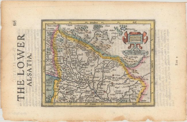
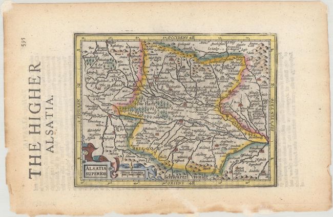
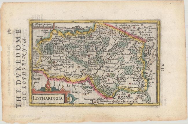
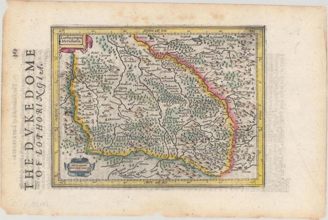
This matching set of maps comes from the English edition of Mercator's Atlas Minor, which was published under the title Historia Mundi or Mercators Atlas by Michael Spark and Samuel Cartwright. After acquiring the plates to the 1607 edition of the Mercator/Hondius Atlas Minor, Sparke republished the maps with text translated into English by Wye Saltonstall. Sparke also had 41 additional maps engraved for the Historia Mundi, most of which were copied from Cloppenburg's edition of Atlas Minor. Included in this lot are four maps of northeastern France within the regions of Alsace and Lorraine, each adorned with decorative title cartouche and distance scale. English text on verso. Sizes vary slightly.
A. Alsatia Inferior. Oriented with north to the right, the Rhine River is shown along the eastern edge of the map extending from Setz to south of Strasbourg, and as far west as Sarrebourg.
B. Alsatia Superior. Oriented with north to the right, this map is centered on the Rhine River, extending from Strasbourg in the north to Basel in the south.
C. Lotharingia. Oriented with north to the left, the city of Metz is shown in the northwest.
D. Lotharingia Meridiona. Nancy is shown at top to the left of center.
References: Van der Krogt (Vol. III) #2521:351, 2522:351, 4250:351, & 4252:351.
Condition: A
Nice impression with light toning along the edges of the sheet and some small chips and tears also along the edges. Alsatia Superior has a professionally repaired tear that just enters the map border at bottom.